Including Pistyll y Graig-ddu.
From Cardiff, take the A470 to Mallwyd (at the edge of the Snowdonia National Park). From Mallwyd, take the A458 towards Welshpool. After 10 miles, just before Llangadfan, take the B4395 to the left towards Llanfyllin (which later becomes the B4393). After 9 miles, it reaches the tiny village of Tycrwyn, where there is a phone box, post box, and the smallest red-brick chapel on the left. Park in the lay-by in front of the chapel. SJ 1032 1834.
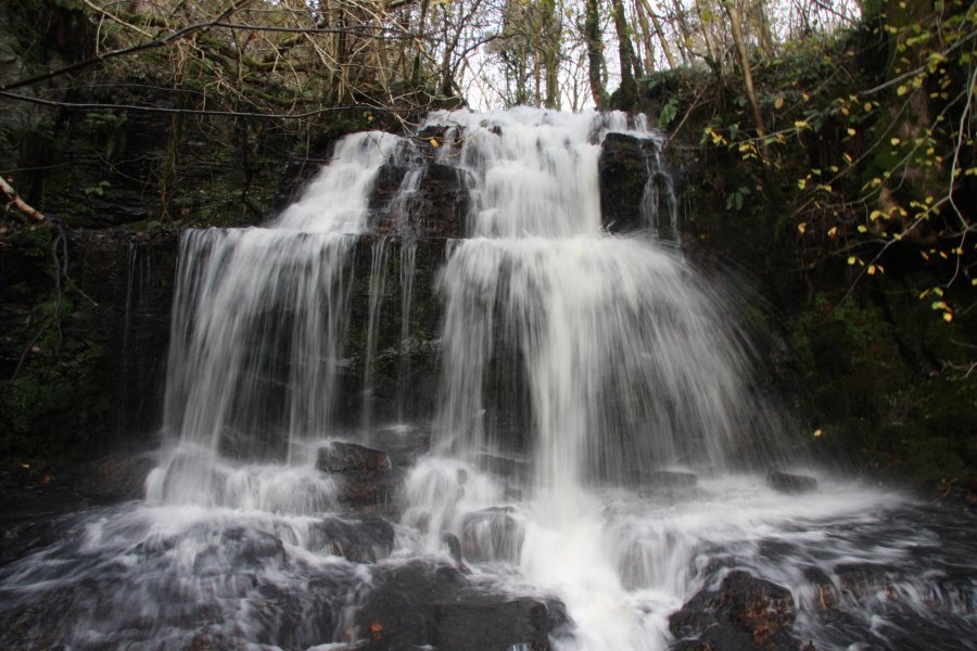
Continue a short way along the road, away from the nearby stream, to the farm on the left (who perhaps should be consulted before crossing the private land containing the waterfall, but I am not sure if they are in fact the owners). To the right in front of the barns is a track leading up into the fields. Follow it as it swings left and climbs to reach a barn at the site of the old farm (the owners of the land?). Follow the track to the right at the barn, and then continue up the little valley. Once it reaches a field, the track splits. Take the left fork, heading towards the stream valley on the left (which may be hard to see at first), and follow it along the valley slopes until it reaches the stream, where there is a waterfall ahead. From there, head downstream along a track on the left bank, beside the fence and main Pistyll y Graig-ddu waterfalls. For most visitors, the waterfalls should be viewed through the trees from this track, and as such, they are best visited in winter. It is possible to cross the fence each time the bottom of a waterfall is reached and very carefully head over to it, taking care to avoid any crags below. The lowest waterfall is just a waterslide, and downstream of that, the stream becomes much more gentle, with only a few trees lining the stream. Return to the start of the walk using the same route.
Expert visitors may want to follow the stream down (note that there is also an inlet stream with a waterfall, above the main waterfalls), and I have personally followed the right bank down most of the drops. However, I advise against this, and suggest the approach given above.
| Waterfall | Grid reference | GPS coordinates | Image |
|---|---|---|---|
| Pistyll y Graig-ddu | SJ 09496 18952 | 52.760564°N, 3.342609°W | |
Whilst every care has been taken in the compilation of this description, neither the author nor his fellow walkers can accept responsibility for loss or injury arising from any errors, omissions or inaccuracies in this description. This description is intended as a guide only, and you should select a route to suit your own abilities, at your own discretion. Ability requirements are a guide only. Route maps are approximated. You follow this description at your own risk.