Including the Nant Ystalwyn waterfall (and a scenic drive).
From Cardiff, take the A470 to Brecon. From Brecon, take the second turnoff at the roundabout, along the A40 to Llandovery. From Llandovery, turn right on the A483 towards Builth Wells. Turn left at the staggered crossroads, signposted to Cilycwm and Rhandir-mwyn. After several miles, the road climbs steeply up out of the Towy/Tywi valley, where a parking area on the left is a viewpoint for the Llyn Brianne dam, a very impressive piece of engineering, with an exceptionally long overflow water-slide. The road then slowly skirts the immense reservoir, remaining on the right side of the valley to continue upstream of the reservoir. Some way beyond the reservoir, the road climbs up the right side of the valley, and part way up, another lane doubles back on the left. Remember this junction, and take the lane on the left. After a little over half a mile, a track forks off on the right, and is the start of the walk. Find somewhere to park, such as the grassy passing space a little beyond it. SN 8052 5682.
On the way back, go back to the junction I told you to remember, turn left and finish climbing the hill, then zigzag very steeply down into the wild Irfon valley. Follow it to Abergwesyn, turn right, and follow the road to Llanwrtyd Wells. Turn right on the A483 to return to Llandovery.
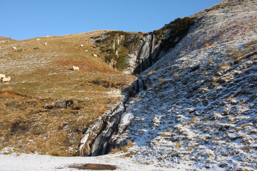
Walk up the track, staying to the right (the upper track) when it forks. After 500 metres, the Nant Ystalwyn Waterfall appears on the right. That's the end of the short walk route.
More experienced walkers may want to make up their own route from here, as the track can be followed a long way through the forestry, and the lower track continues up the valley for a very long way from the fork, with some routes completely traversing the Cambrian Mountains. One possible extended walk route is described here. Return down the track to the fork, and take the lower branch which is now on the right. Follow the lower track up the valley, taking a left at every proper junction (except the one leading to the Nant-ystalwyn farmstead), until the track eventually reaches a ford over the main river. A smaller path on the left, just before a small stream, then leads up to a track. Turn left, and use the same approach again - taking every left - at each junction, to eventually reach the mountain road. Follow it to the left to reach the start of the walk. I have not followed this route, but I suspect it could also work as a cycling route, at about 12 km long.
| Waterfall | Grid reference | GPS coordinates | Image |
|---|---|---|---|
| Nant Ystalwyn Waterfall | SN 80710 57287 | 52.200865°N, 3.746898°W | |
Whilst every care has been taken in the compilation of this description, neither the author nor his fellow walkers can accept responsibility for loss or injury arising from any errors, omissions or inaccuracies in this description. This description is intended as a guide only, and you should select a route to suit your own abilities, at your own discretion. Ability requirements are a guide only. Route maps are approximated. You follow this description at your own risk.