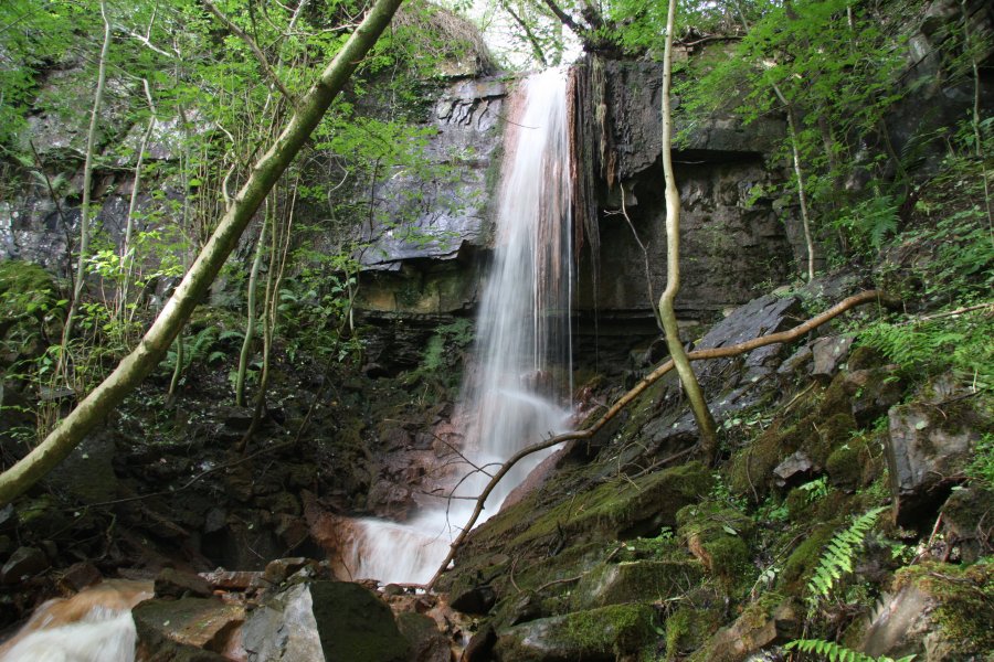
Including the Blaenant y Gwyddyl waterfall.
From Cardiff, take the A470 to the end of Merthyr Tydfil. From Merthyr Tydfil, take the A465 to the left towards Hirwaun, follow it over the hill, and down to the next roundabout. Take the second turnoff, remaining on the A465, to the next roundabout. Take the second turnoff onto the A465 dual carriageway. Take the first exit off the road after about 4.5 miles. Go ahead at the traffic lights (the start of Glyn-neath), then as the road swings right, continue ahead onto Lon y Nant. When it turns left, continue ahead again, back onto Lon y Nant. Park on that road. SN 8834 0683.
On the right side of Lon y Nant, the narrow Glynmelyn Road leads off through a ford. Follow it up until it ends at some buildings. In theory at this point, a fenced track continues ahead, curving left to reach the Cefn-isaf Farm, but it may be too overgrown to use. If the track is too overgrown, a route over the fields might be needed instead; where the road ends, enter the field on the left, follow its right side to enter the next field, and from there continue to the farm. Ask for permission to use the farm tracks (they also have a driveway from the A4109, but there is nowhere useful to park).
Head toward's the farm's driveway. Just past the farm on the left, an overgrown track leads down towards the top end of the nature reserve - try to hold roughly the same direction heading away from the farm, ignoring side tracks. After the track crosses a small stream, follow a path running along the left edge of the field, beside the stream, to reach the reserve's forest. Locate and follow a path heading downhill into the reserve, away from the small stream. It reaches the main stream above the lower waterfall. Ford the stream and head directly up the opposite bank along the remains of a path. When this reaches the base of the cliffs, head to the right along the base of the cliff to reach the main waterfall.
This nature reserve does in theory have several paths running through it from the end of Lon y Nant. However, those paths have been obliterated by the undergrowth, and cannot be followed far, even by expert-level visitors.
| Waterfall | Grid reference | GPS coordinates | Image |
|---|---|---|---|
| Blaenant y Gwyddyl | SN 88544 07859 | 51.758291°N, 3.616248°W | |
Whilst every care has been taken in the compilation of this description, neither the author nor his fellow walkers can accept responsibility for loss or injury arising from any errors, omissions or inaccuracies in this description. This description is intended as a guide only, and you should select a route to suit your own abilities, at your own discretion. Ability requirements are a guide only. Route maps are approximated. You follow this description at your own risk.