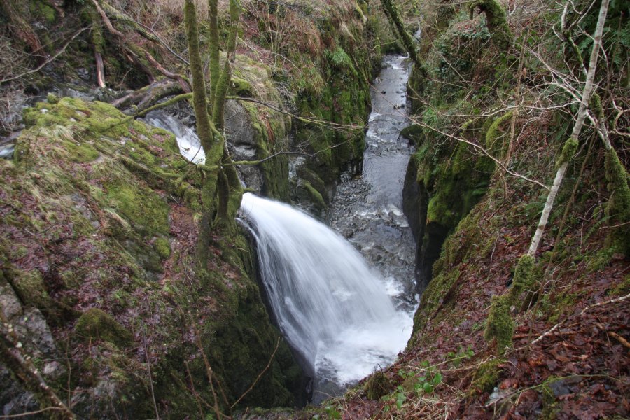
Including Pistyll Henfynachlog.
From Cardiff, take the A470 to Dolgellau. From Dolgellau, take the A494 towards Bala. At Rhydymain, take the little road that loops through the village, and park next to the bridge over the river. SH 8046 2214.
Note that the maps of this area are badly outdated, and lacking essential details, but a map is very useful to show which fields have rights of way through them, as the paths are indistinct. Cross the bridge to the right bank of the river (looking upstream). Take the gate beside the house on the upstream side of the bridge, then head up to the right to a fenced field. Follow the fence up to the start of the forest. Stay above the right edge of the forest, climbing up through fields. Stay near the top of the trees, through the gate, and beside a farm. 100 metres past the farm, a path drops down to the left, into the Allt y Benglog nature reserve.
Follow the path over the river bridge until it reaches some more fields, then follow an unofficial path along the bottom edge of those fields to the right. After a few fields, this leads to the head of the Pistyll Henfynachlog waterfall. Turn around and follow the path back to the bridge path (but don't go back over it), then head directly away from the river, up through fields, to the Ty-cerig farm. The map fails to show some of the old walls here, so try to work it out as best you can. At the farm, turn left in front of the buildings, initially following the far side of a wall that runs to the left in front of the farm. When the wall ends at the top of a large field, continue in the same direction (towards Rhydymain) over the field towards its far end, passing the remains of a building, and curving right to leave the field just before its end, crossing a small stream. After crossing the stream, drop down through a small forest to the left, passing through a clearing, eventually arriving back at the village. Follow the road near the river, back to the start of the walk.
| Waterfall | Grid reference | GPS coordinates | Image |
|---|---|---|---|
| Pistyll Henfynachlog | SH 80762 23100 | 52.792252°N, 3.769733°W | |
Whilst every care has been taken in the compilation of this description, neither the author nor his fellow walkers can accept responsibility for loss or injury arising from any errors, omissions or inaccuracies in this description. This description is intended as a guide only, and you should select a route to suit your own abilities, at your own discretion. Ability requirements are a guide only. Route maps are approximated. You follow this description at your own risk.