White Water 2010
Penrhyn-gwyn, Helygog Falls, Llam yr Ewig, Pistyll Cablyd, Pistyll Blaen-y-cwm, Afon Eirth Falls, Pistyll Gwyn - Nant y Pistyll-gwyn, Rhaeadr y Cwm, Afon Du-bach, Maesgwm, Afon Cwm Llan, Rhaeadr Cwm Dyli, Cwm Cneifion Falls, Devil's Kitchen, Devil's Appendix, Llyn yr Oror. And Cwm Pwll-y-Rhyd. Waterfalls and snow around Snowdonia. And Pontneddfechan.
Penrhyn-gwyn
This set of waterfalls is located on the stream that drains Llyn Gafr and the surrounding face of Cadair Idris. A small mining site, "Chwarel Penrhyn-gwyn", named after the nearby farm, is surrounded by the waterfalls. The waterfalls are popularly used by gorge walkers, who apply the same name to the waterfalls as well - it seems likely that the name (meaning "white promontory") always referred to the waterfalls anyway. We were accompanied for the walk by David, a local gorge walking leader.
 Starting at the Ty-nant car park, under the superb face of Cadair Idris. The route begins by following the normal Cadair Idris footpath on the right of the cottage. When the normal footpath swings away from the stream, stay by the stream until the less-used path passes through a gate into open access land. Turn left.
 Bryn Brith (383 metres), a small but distinctive hill near Arthog.
 The path soon reaches the base of the main incline, beside a derelict building. Follow the incline up to the main quarry buildings.
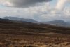
 Inversion over Llyn Gwernan, with Y Garn (629 metres) in the Rhinogydd behind it.
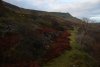 There are two levels of buildings at Chwarel Penrhyn-gwyn, with the upper bench shown here. The quarry sits above the upper level. The lower level has a path that continues as a deteriorating tramway above the stream, which can be used with care as an access route.
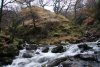 The tramway reaches the stream at a junction. The first two waterfalls lie downstream, with further waterfalls on both upstream branches. To get downstream, ford the stream, and follow a path on the far bank.
 The lowest waterfall at Penrhyn-gwyn. It is around 7 metres tall in total, and it is possible to walk behind the left side of it. This requires careful balancing on rocks, and full waterproofs are advised.
 Cascades above the previous waterfall.
 Small waterfall on the left branch.
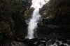 Larger waterfall above it, about 6 metres tall. To view this, walk up the buttress between the streams.
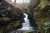 Small waterfall on the right branch.
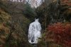 10 metre waterfall above it.
 Inversion in front of the Rhinogydd ridge.
 If you know what you are doing, there is another way back from here; at the stream junction, there is a mine adit.
 Roughly 40 metres long.
 The end is choked, but cavers can scramble up into the bottom of the deep quarry. A path leads around the left side of the quarry and down to the quarry buildings.
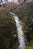 Another path leads above the stream, where just upstream is the final waterfall, also around 10 metres tall.
Helygog Falls
Situated on the B4416 (near Dolgellau) is the tiny village of Brithdir. This is well known for the nearby Torrent Walk, but the lane leading from the village to Bryn Coed-Ifor gives access to a far more demanding waterfall. Just after the lane stops following a roman road, it passes over the Nant Helygog, which is where this short scrambling walk begins. There is limited parking space.
 The extinct volcano Rhobell Fawr (734 metres) in the Arenigau.
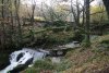 Immediately below the road is a small weir, which was previously used to feed a turbine.
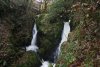 Twin waterfalls just below the weir.
 Immediately below is the next waterfall, and concealed by a tree is an iron ladder, which can be used to reach the remains of a turbine at the base. However, this ladder has suffered significant damage, and is not an official aid. You use it entirely at your own risk.
 Near the top of the ladder, a rockfall had severely bent it, with one rock lying on the ladder, wobbling but not removable. That was "fun".
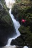 The waterfall, however, is quite spectacular in these high-flow conditions. 14 metres of thundering water.
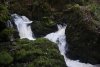 Cascades downstream.
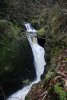 Cascades.
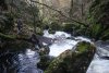 To get downstream, it is best to climb back up onto the bank, then locate an appropriate point to descend. We traversed the gorge wall, reaching a dislocated part of the ladder which had been placed to descend the bank.
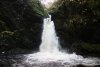 A tricky traverse back upstream then reached the bottom of the final waterfall.
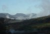 Superb view of the southern Rhinogydd range; crags of Y Garn, Y Llethr (756 metres), Rhinog Fach (712 metres) and Rhinog Fawr (720 metres).
Llam yr Ewig
The last of David's waterfall sites. At the southern end of Coed-y-Brennin is the village of Llanfachreth. From there, a lane heads down towards Dolgellau. The first road to the right then leads down to the Mawddach valley. Early on, it crosses a bridge, with some parking areas just before the bridge. The bridge is called Pont Llam yr Ewig, meaning "the bridge of the deer's leap". The waterfalls lie directly under the bridge, so the leap (river crossing) would presumably have been over the head of the main waterfall. The name is therefore transposed to the waterfalls.
Pistyll Cablyd, Pistyll Blaen-y-cwm, Afon Eirth Falls
Locating routes around this valley has been exceptionally hard, due to the intentional blocking and removal of footpaths by landowners. After a previous failed attempt to view Pistyll Cablyd, we finally managed to work out how to reach it without crossing private land. Note that its location is not correctly marked on most maps; the waterfall lies on the boundary of the open access land above the Tyn-y-cablyd farm, and can be viewed without needing to request special permission. To make things easier, I have prepared a route guide for the best access routes.
 St. Melangell's Church, the focal point of the village, and the only dedicated parking area in the valley.
 Our route, which does not follow the routes in the guide, started by taking the nearby path into the Nant Trefechan valley. Only one of the three paths was marked at the farm, and to avoid irritating them, we took the wrong path (on the left of the stream) to get into the forestry, then made our way back to the path we wanted to take (on the right of the stream).
 Our path followed an old forestry track, climbing very steeply up the right side of the stream. After a couple of zig-zags, the track levelled out a little, with several fire tracks all joining together.
 We took the fire track up to the right, reaching a proper track running along an almost flat ridge. This took us slowly up to the edge of the forestry.
 View over the lower part of Cwm Pennant from Nant y Saer.
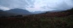
 After locating the open access land, the route began to descend into the Nant Achlas valley. On the left is Cyrniau Nod (667 metres), and on the ridge beyond the far side of the valley is Post Gwyn (665 metres), with some of the main Berwyn tops behind it.
 At the very edge of the open access land, the stream splits and rejoins, immediately before plunging down a waterfall. The stone wall and rope bridge mark the end of the open access land. The Tyn-y-cablyd owner has tried very hard to prevent visitors from approaching from the valley bottom (unless, it would seem, they are using the farm's holiday village), but thankfully, it can be seen from the bridge.
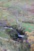 A small waterfall upstream has a small dam and sluice gate. The only purpose this seems to serve is to allow the water to be stored up, and sent down the main waterfall in a large pulse - a visitor attraction for holiday village guests, perhaps.
 The rope bridge seems very well built, and we are not sure if it is official or not, but it leads through a private field, so it is best not to continue on the far side.
 Pistyll Cablyd starts just upstream of the bridge, with this upper part dropping about 8 metres.
 It continues under the bridge.
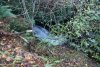 It ends just downstream of the bridge, having dropped a total of about 14 metres.
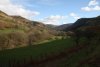 Not wanting to hang around on the edge of the private land, we returned back up to the edge of the fields on the far bank of Nant Achlas. A path running along the edge then dropped us into Cwm Pennant, where we continued to the head of the valley.
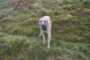 A dog (which we assume belonged to the farm) appeared at the waterfall, and adopted us for the rest of the walk, determined that we must be responsible for it. It appears to be a Scottish deerhound, and certainly was as fast as one.
 Nant Pen Cerrig dropping down some small waterfalls on the far side of the valley.
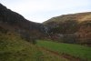 The fields finally end at the head of the valley, under its largest waterfall.
 This is Pistyll Blaen-y-cwm, 107 metres in total, with the largest drop being 30 metres. The waterfall has a distinctive character, with ledges and cracks splitting the water into multiple strands. The one on the left manages to drop for a little over 15 metres in a single step.
 Woodworm.
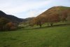 Our route followed the tops of the fields again, down the far side of the river, eventually dropping to the road through fields on a public right of way (one that is properly maintained, for once).
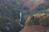 While heading back along the roads towards Bala, the Afon Eirth Falls appeared at the head of Cwm Rhiwarth. These drop around 20 metres in total, with the tallest single drop being about 8 metres. These do not have any official name, and are simply named here after the river. Several other small streams in the valley have waterfalls, but none are very big, and none have names.
Pistyll Gwyn - Nant y Pistyll-gwyn, Rhaeadr y Cwm, Afon Du-bach
Just outside Llan Ffestiniog is the junction between the B4391 and the B4407. About 1 km along the B4407 from the junction, the road passes over the Nant y Pistyll-gwyn stream. Just upstream from there is a small waterfall. As the only proper waterfall on the stream, it would appear that the stream's name refers to this waterfall, which therefore is evidently called Pistyll Gwyn.
 Arenig Fawr (854 metres), the tallest of the Arenigau.
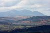 The Snowdon Horseshoe; Y Lliwedd (898 metres), Yr Wyddfa (1085 metres), Garnedd Ugain (1065 metres) on the Crib y Ddysgl ridge, and Crib Goch (923 metres).
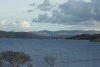 Llyn Celyn, the infamous reservoir established in the 1960s on the Afon Tryweryn, flooding the last Welsh-only speaking community in Wales. It was constructed to supply the English city of Liverpool, after the proposal was ratified by a parliamentary vote. 35 of the 36 Welsh MPs took part in the vote, and all of those voted against the plan. However, they were outvoted by the more numerous MPs from England. This incident showed the lack of Welsh power to control their own country, and was heavily influential in the establishment of the Welsh Assembly.
 Approaching the Moelwynion range; Moelwyn Bach, Craigysgafn (689 metres), Moelwyn Mawr (770 metres), Moelwyn Mawr North Ridge Top (646 metres) and Moel-yr-hydd (648 metres), with Cnicht (689 metres) behind them.
 Quarry by Moel Llechwedd-gwyn.
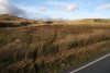 Nant y Pistyll-gwyn, seen from the road. The waterfall lies in the centre of the picture.
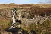 Pistyll Gwyn, a waterfall sharing its name with several others in the area, including one just on the other side of the Arenigau. This one is only about 6 metres tall.
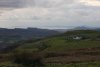 View of Porthmadog from a tiny car park on the side of the B4391, on the way to Llan Ffestiniog.
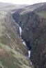 Rhaeadr y Cwm, seen from the nearby viewpoint. About 80 metres in total (a few drops are not visible in this picture), with the tallest drop being 20 metres.
 Distant view of the Afon Du-bach, seen over Blaenau Ffestiniog. The fairly short waterfall only gets attention because of its location.
 Immense tips of discarded slate at Llechwedd.
Maesgwm
 Castle Dolwyddelan at Dolwyddelan. In the village centre, take the side road heading south through the village, beside several churches and a pub. Cross a bridge, take the right fork then right turn to cross the next bridge. The lane then heads into Cwm Penamnen.
 The lane follows Sarn Helen, a long roman road that can be traced all the way down to the Brecon Beacons in South Wales.
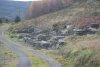 Tai Penamnen, the remains of a village. There is some limited parking at some picnic tables just beyond this, which is the only good place to park in the whole valley.
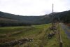 Walk down the lane, which soon becomes a dirt track. After passing through the garden of a cottage, the waterfall comes into view. If you want a longer walk, return on the other side of the valley, and locate the footbridge that returns you to the parking area.
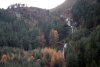 The Afon Maesgwm, on the right side of the valley, tumbles from a shallow valley down a series of waterfalls called Maesgwm.
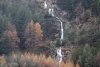 The tallest drops are a little over 10 metres, but careful reading of the maps shows that the total drop is an impressive 100 metres.
 A hazy view of Snowdon's Yr Wyddfa, Crib Goch and Garnedd Ugain from Capel Curig. Why does this mountain never give me a clear view of its two tops when I am close enough to see it properly? Don't answer that.
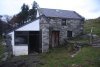 After a late change in bookings, we settled into an overflow bunkhouse nestled in the hillside, with a terrible access lane, spider-filled toilet that smelled like a chicken coop, outdoor sink-without-plumbing, and pretty much nothing else.
 There was a gas stove and rusty saucepans though. But hey, aside from the cold and dirt, this has to be one of the greatest bunkhouses in Snowdonia. An experience instead of a 5 star hotel.
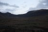 Carnedd Llewelyn (1064 metres) and Pen yr Helgi Ddu (833 metres), somewhere above our bunkhouse.
 And the superb view of the mountains surrounding the Llugwy/Ogwen valley, seen from our bunkhouse; Gallt yr Ogof (763 metres), Tryfan (917 metres), Foel-goch (831 metres), Pen yr Ole Wen (978 metres) and Carnedd Dafydd (1044 metres). That night, the sleet poured...
Afon Cwm Llan, Rhaeadr Cwm Dyli
 By morning, the mountain tops had been transformed. Same mountains as before; Gallt yr Ogof, Tryfan, Foel-goch, Pen yr Ole Wen and Carnedd Dafydd.
 Foel-goch, Pen yr Ole Wen and Carnedd Dafydd.
 Red sky in morning, means a great day, right?
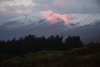 Could I ask for better?
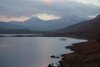 The Snowdon massif over Llynau Mymbyr. Visible are Gallt y Wenallt (619 metres), Lliwedd Bach (818 metres), Y Lliwedd East Peak (893 metres), Y Lliwedd and Crib Goch. The main tops are, of course, missing.
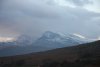 Crib Goch seems to have grown by 1000 metres or so overnight.
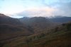 The back of the Glyderau ridge was also dusted white, but sadly with a cloud cap.
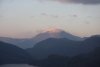 Moel Hebog (782 metres) with its own personal snow cloud.
 Yr Aran's 747 metres had been just enough to snag some snow as well.
 Snow and sunrise on the back of Y Lliwedd.
 The waterfalls are easily reached by following Snowdon's Watkin Path from Nantgwynant.
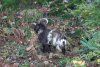 One of the local goats helping to keep the undergrowth in check, and simultaneously making the mountainside smell distinctively musky.
 Remains of the old tramway incline.
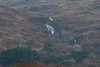 Cascades on the Afon Merch, on the back of Gallt y Wenallt. These can be clearly seen from the Watkin path, but are not actually very tall - less than 20 metres in total.
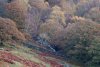 At the bottom of the valley, the same river produces some more noisy cascades.
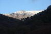 Then we step out of Wales and into the Himalaya. This superb view is of the Bwlch Maen ridge leading up to Snowdon - the top of which is just hiding off to the right.
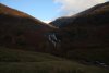 As the path reaches the first bench of Cwm Llan, the waterfalls come into view. This was used as the filming location for the Khyber Pass in the 1968 film; Carry On... Up the Khyber. The border gate in the film was located just above the left side of the waterfall.
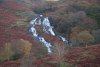 The waterfalls are about 30 metres tall in total, dropping in several steps, the largest of which is about 10 metres tall.
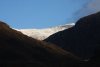 Yr Wyddfa, the top of Snowdon, has now just come into view, but we're heading elsewhere.
 Light and lumps on Y Lliwedd.
 Tumbling out of Snowdon's horseshoe is Rhaeadr Cwm Dyli. It drops a total of about 100 metres, and most of that can be clearly seen from the A498 Snowdon viewpoint.
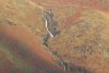 The largest drop is only about 10 metres.
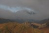 Then at long last, Snowdon decides to let me see the Yr Wyddfa top, and its immense 480 metre cliff. The window in the clouds is such a beautiful effect. (For the sake of honesty, I have to admit that this is a composite picture, made from a couple of lucky shots taken from a moving car - one showing the left crags, and one showing the right crags. The originals were not too dissimilar, but had damage caused by motion blur, and clipping caused by the clouds.)
Glyderau in snow, Cwm Cneifion Falls, Devil's Kitchen, Devil's Appendix
 Just in case we had not already been lucky enough, the Glyderau gave us a spectacular welcome at Y Garn (947 metres), with cloud in the hanging glacial valley appearing to be smoke from an active volcano.
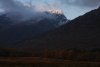 Superb light and snow on Foel-goch.
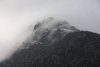 Clouds peeling off Tryfan.
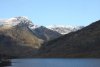 Foel-goch and Mynydd Perfedd (812 metres) over Llyn Ogwen.
 Passing Nant Bochlwyd.
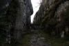 Our route starts at the Idwal Cottage. Rather than follow the usual path, we decided to take the less travelled route around Llyn Idwal, starting by heading up through the Idwal Slate Mine. For this walk, we were accompanied by two more friends, who coped admirably despite having been told to expect only a short walk.
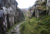 The mine is an open quarry, with an easy pathway.
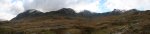 View from the end of Cwm Idwal; Tryfan, Glyder Fawr (1001 metres) and Y Garn.
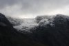 The Nameless Cwm/Cwm Cneifion, a massive hanging valley on Glyder Fawr.
 Nant Ffrancon, a huge glacial valley carrying the Afon Ogwen between Mynydd Perfedd and Pen yr Ole Wen.
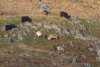 Carneddau Ponies, the northern branch of the wild Welsh Mountain Ponies, seen here on the flanks of Y Garn.
 Llyn Idwal, surrounded by all of the waterfalls that we were here to see.
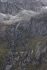 Falling out of Cwm Cneifion are some waterfalls without an official name, so I refer to them as Cwm Cneifion Falls. The total drop is about 63 metres, while the tallest single drop is about 12 metres. Though you probably cannot see them, there is a walker in blue at the bottom, and two walkers in red at the top.
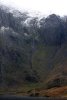 The most obvious inlet. This drops for some 300 metres over about 700 metres of horizontal distance, making this clearly just a very tall white-water stream (probably the tallest in Wales). The tallest actual waterfall parts of it add up to a little under 40 metres.
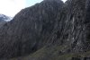 Next is a black smudge which does contain a small horsetail waterfall, but the height of the tallest drop is significantly under 20 metres. Interesting, but not big enough to set any records.
 Next is the gorge of the Devil's Kitchen/Twll Du. On its right, the blackened wall is the Devil's Appendix waterfall, the tallest single drop waterfall in Wales, at 93 metres. In this low flow (even after the sleet), it is partially broken, but never stops dropping until it reaches the bottom.
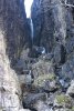 The Devil's Kitchen is an impressively deep gorge, dropping at a very steep angle. There are two waterfalls at its head, dropping a total of a little over 24 metres (according to climbing guides). The upper one (seen here) is about 20 metres in height.
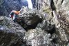 The gorge begins with a grade 1-2 scramble. This barres access to normal walkers.
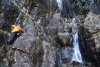 There are scrambles further up as well.
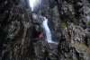 The first proper climb is known to climbers as the boulder overhang. It is made by a large, wedged boulder with plenty of space beneath it, which allows you to walk behind the waterfall - waterproofs are advised.
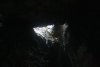 Inside the space, more water spills in from further holes behind the boulder.
 This gives a quite unique situation with a waterfall behind a waterfall. In addition, it is possible to walk behind that as well, meaning that you can walk behind the waterfall behind the waterfall (cue Mad Xzib). This is the only known waterfall in Wales where this is possible.
 Getting beyond this point requires climbing skills and equipment, so we turn back.
 With the immaculate conditions, we could not resist, and decided to extend our little walk to a proper walk over the Glyderau. The stunning view from Cwm Cneifio (note the different spelling) should show why. Y Garn, Pen yr Ole Wen, Carnedd Dafydd, Pen yr Helgi Ddu, Pen Llithrig y Wrach (799 metres), Tryfan and Glyder Fach (994 metres).
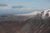 Gyrn Wigau (643 metres) and Drosgl (758 metres).
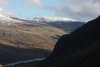 Pen yr Helgi Ddu.
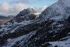 By far the best picture I have ever taken of Tryfan.
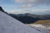 View over all of the less well known mountains of the Snowdon massif. On the near ridge is Llechog (718 metres), then behind that is the ridge containing Moel Cynghorion (674 metres), Foel Goch (605 metres), Foel Gron (629 metres) and Moel Eilio (726 metres). Behind them is Mynydd Mawr (698 metres) in the Moel Hebog range.
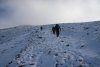 The steps from the Devil's Kitchen may seem steep, but they are nothing compared with the slopes above the pass. Glyder Fawr is another 300 metres up over scree, and even with the snow there, it really dragged on.
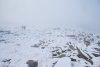 Sadly, the cloudbase dropped, so we lost the visibility, and continued up in the fog.
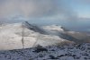 The northerg Glyderau; Y Garn, Foel-goch, Mynydd Pervedd and Carnedd y Filiast (821 metres).
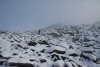 Approaching the Glyder Fawr top.
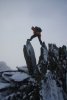 Top of Glyder Fawr.
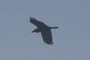 Raven flying through the fog. I wonder how they know where the crags are, and how often they accidentally fly into one.
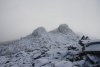 Other tops. The one on the right looks as tall as the main top.
 Alien landscape.
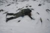 Perfect place to make a snow angel, right? Face down 'cos of the bag.
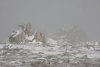 Outcropping spikes.
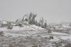 This one even has a face.
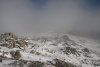 Wishfully thinking that it could it be clearing.
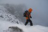 Walking the cornice (no, not a real one...).
 Time for another snow ang...urmphphp!
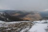 Moel Siabod (872 metres).
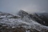 Castell y Gwynt (972 metres).
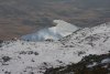 Llyn Cwmffynnon and reflections of a blue sky.
 Spiked rock on Castell y Gwynt.
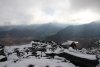 Moelwynion ridges with Y Lliwedd on the right. Visible are the Ysgafell Wen tops; Ysgafell Wen Far North Top (650 metres), Ysgafell Wen North Top (669 metres) and Ysgafell Wen (672 metres), with Cnicht to their right.
 Skirting Castell y Gwynt, with no hint of a path. Immediately after taking this picture, Nikki dropped a child ... er ... a stuffed sheep called Syd, which had been tucked into her bag's straps, and didn't notice.
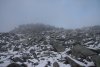 She noticed 300 metres later, just as we were approaching Glyder Fach, and so began the search - hey, at least with snow, you can see where you have been, but ... er ... why am I searching for this sheep?
 -300 metres later, and I gave up and turned back. Then realised that in that gap at my feet...
 ...There was a sheep. The law of probabilities says that this is impossible.
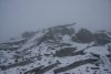 The cantilever, near the Glyder Fawr top.
 Clearing cloud over Cwm Bochlwyd. Y Garn, Elidir Fawr (924 metres), Foel-goch, Mynydd Pervedd, Carnedd y Filiast, Pen yr Ole Wen, Carnedd Dafydd, Carnedd Llewelyn, Tryfan, Pen yr Helgi Ddu and Pen Llithrig y Wrach.
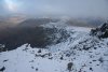 Y Foel Goch (805 metres) and Gallt yr Ogof.
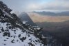 The way down gets quite steep here, but does not need any climbing equipment.
 A dog's face in the ice. I think it's an Airedale.
 Steeply down into Cwm Tryfan.
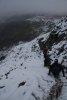 Too steep for comfort.
 Looking up the couloir that we were descending.
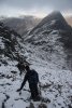 Approaching Bwlch Tryfan.
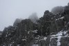 Spikes on Glyder Fawr.
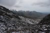 From Bwlch Tryfan, the route heads down into Cwm Bochlwyd. Even here, it's still a very long way down.
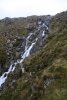 White water on Nant Bochlwyd. By now, we were running out of daylight, and needing to get to the next walk, so we said our goodbyes, and parted company on the mountainside.
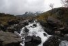 Running past Afon Idwal, near the end of the walk.
Llyn yr Oror
This waterfall has no proper access route, and must be approached with extreme caution, by experienced walkers only. It lies downstream of Rhaeadr y Bedd near the Aled Isaf reservoir, but the gorge-top paths from there die out before reaching the waterfall. The forestry on the southeast bank has some tracks above the waterfall, and it is possible to scramble down the banks to view it from above. However, the cliffs on that side are quite dangerous, so to best view it, you need to locate footbridges upstream or downstream of the waterfall, cross to the far bank, and very carefully approach it from the northwest bank. There is no proper path from that side, and there is no access from the Clwydian Way.
 The waterfall lies in the forest, Coed Cleiriach, on the left of this picture. By the time we got here, the light was already failing fast, and the camera's focal range suffers badly as a result (plus I think there was some mist in the lens). It was absolutely black in the forests, and by the time we reached the waterfall, there was only just enough light for us to see a shadow of it with our own eyes.
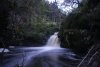 The 5 metre Llyn yr Oror. With the camera balanced on a shaking fallen log, and our head-torches inadvertently throwing too much light into parts of the picture, this result had to be constructed from a 3 second shot (top) and 6 second shot (bottom). Amazingly, it just looks like a cloudy day. I could, of course, have tweaked the brightness and colours excessively to make it look better, but this is intended to be an honest representation of what has been termed "the gloomiest waterfall in Wales".
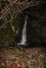 A small inlet stream has its own waterfall. Unfortunately, this also makes it very difficult to reach the main fall. A mossy scramble just beside the inlet is required to get down to it.
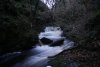 Just downstream in the Afon Aled is a small but powerful cascade. It is worth noting that the pictures here were taken when the reservoir was not overflowing. If it had been overflowing, it would almost certainly be too dangerous to be here.
Cwm Pwll-y-Rhyd
This South Wales waterfall is normally completely dry, with the Nedd Fechan river sinking into various caves. The river only reaches the waterfall in flood conditions. A couple of weeks after the trip to the earlier waterfalls, careful monitoring of river levels finally paid off. The visit was a little bit late in the day, roughly at sunset. The gloomy feel, however, is due to the black clouds, and not the time of day. Since the waterfall only appears after heavy rain, this is a sacrifice that must be made.
The Environment Agency offers river level monitoring which can be used to monitor major rivers. The Neath at Resolven station gives an idea of the river level in the upper Nedd Fechan - one of the major feeders of the Neath. My visit was made on a day when the river level had reached about 1.25 metres, a day after it had reached 1.5 metres. The maximum level considered to be in the river's typical range is about 1 metre, which is not normally enough for the waterfall to appear.
 The river seen from Pont Cwm Pwll-y-Rhyd. With part of the river flowing into the Little Neath River Cave some way upstream, the remainder usually sinks at the corner seen in this picture, where a small passage can be followed into Bridge Cave.
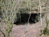 Just downstream from the bridge is the large entrance of Bridge Cave, which takes the river into Little Neath River Cave.
 In high water, the river sinks into a swallow hole in the river bank a little way downstream, and makes its way into Bridge Cave. Any water that makes it past this point would normally sink into the river bed. In these flood conditions, however, the swallow hole cannot cope, and ponds up to 2 metres deep, with the river continuing past it.
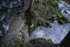 With the deep pool blocking the path, the way downstream is to very carefully traverse along an exposed, muddy ledge a few metres up in the cliff. Only experienced visitors should attempt this route.
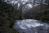 Finally free, the Nedd Fechan charges onwards into a little gorge, but that ominous fog at its end gives away what lies ahead.
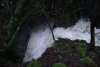 The path leads up over the gorge, from where there is a superb view of the river thundering down into Cwm Pwll-y-Rhyd (originally this was just called Pwll-y-Rhyd, but cavers have applied the name of the valley to the cave). The river never makes it past this point, where it is swallowed by the Cwm Pwll-y-Rhyd, White Lady and Town Drain caves, and onwards into the Little Neath River Cave.
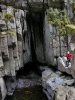 This is how the 4 metre waterfall normally looks, and looked on my visit in 2008.
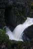 In these flood conditions, it's hardly recognisable as the same place. The plunge pool is 2 metres deeper than normal, and a natural rock bridge causes some of the water to be ejected part way down the waterfall.
 The dry valley that continues is the original Cwm Pwll-y-Rhyd.
 Alcoves hide additional entrances to the cave system.
 Starting at the Ty-nant car park, under the superb face of Cadair Idris. The route begins by following the normal Cadair Idris footpath on the right of the cottage. When the normal footpath swings away from the stream, stay by the stream until the less-used path passes through a gate into open access land. Turn left.
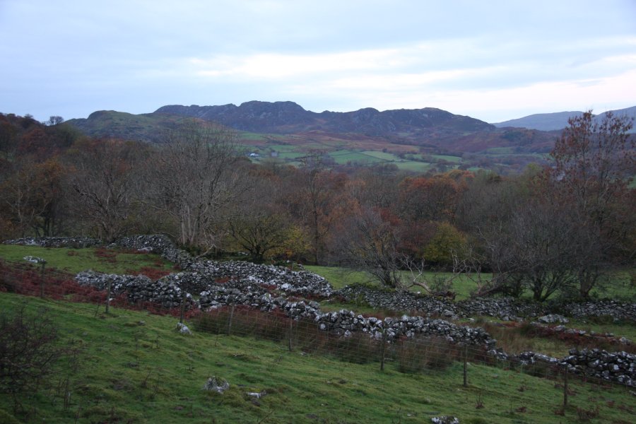 Bryn Brith (383 metres), a small but distinctive hill near Arthog.
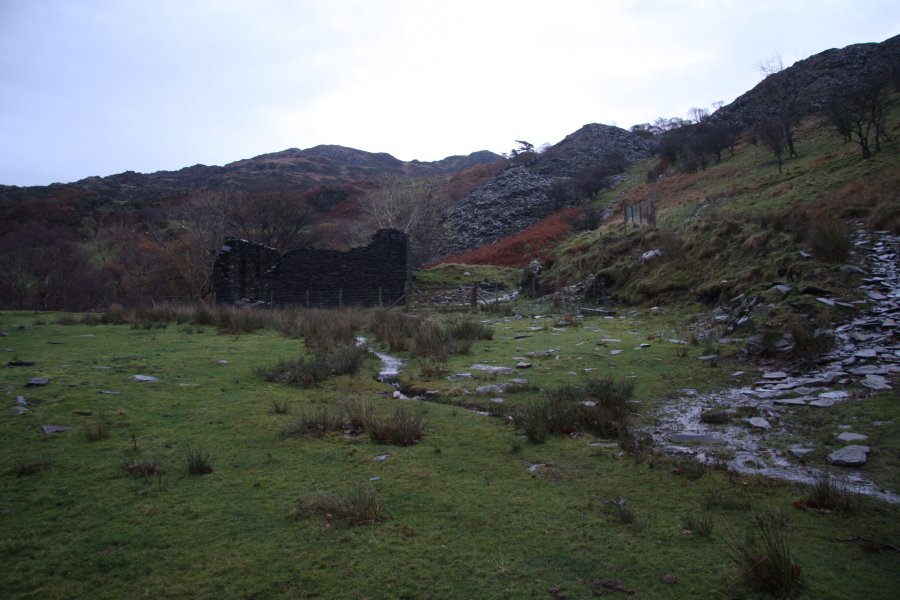 The path soon reaches the base of the main incline, beside a derelict building. Follow the incline up to the main quarry buildings.
 Inversion over Llyn Gwernan, with Y Garn (629 metres) in the Rhinogydd behind it.
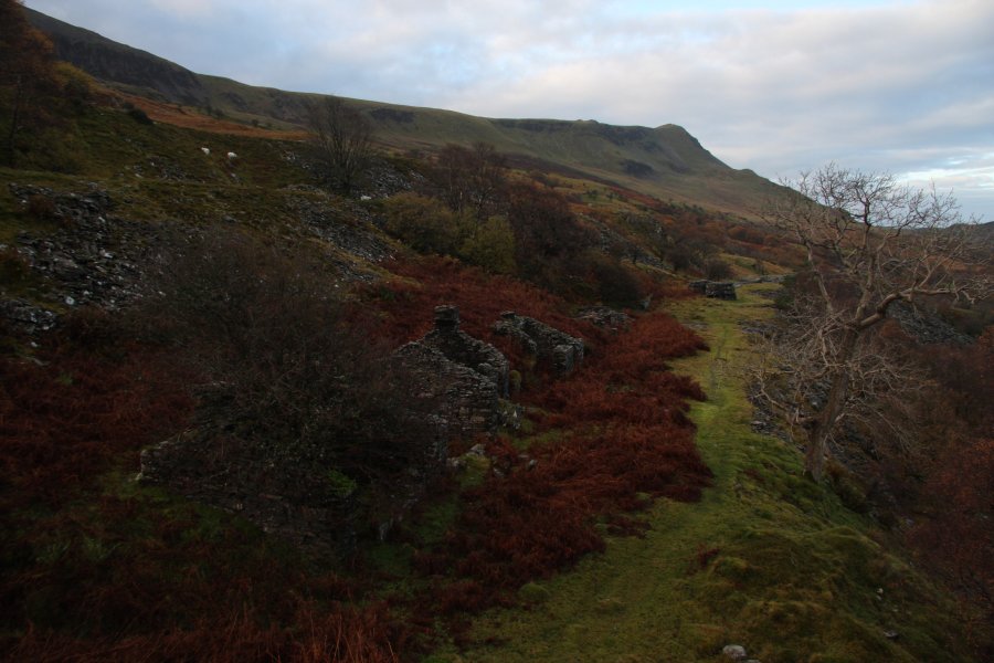 There are two levels of buildings at Chwarel Penrhyn-gwyn, with the upper bench shown here. The quarry sits above the upper level. The lower level has a path that continues as a deteriorating tramway above the stream, which can be used with care as an access route.
 The tramway reaches the stream at a junction. The first two waterfalls lie downstream, with further waterfalls on both upstream branches. To get downstream, ford the stream, and follow a path on the far bank.
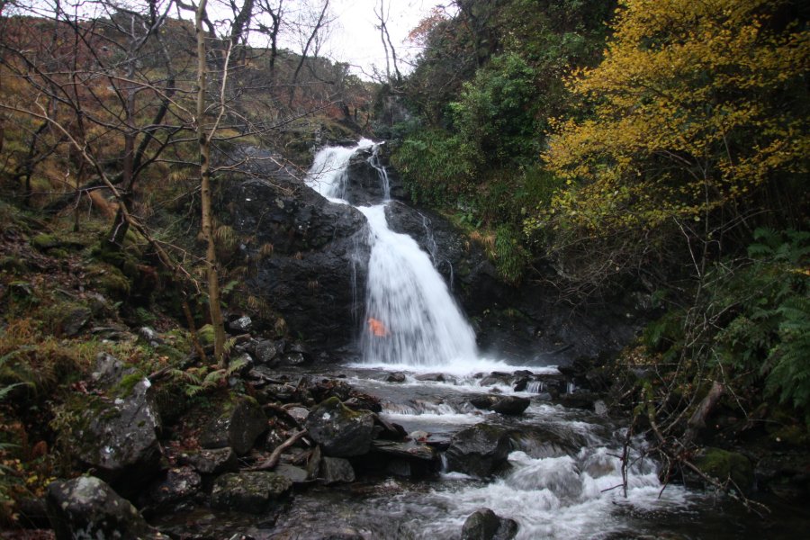 The lowest waterfall at Penrhyn-gwyn. It is around 7 metres tall in total, and it is possible to walk behind the left side of it. This requires careful balancing on rocks, and full waterproofs are advised.
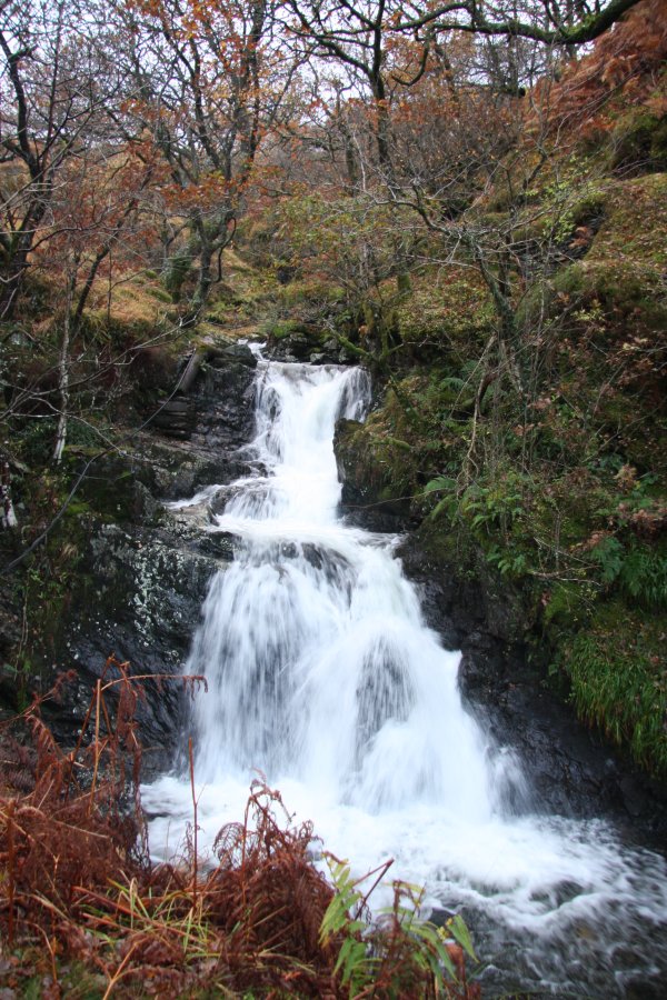 Cascades above the previous waterfall.
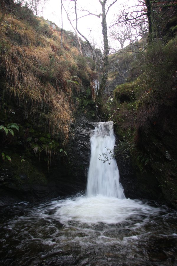 Small waterfall on the left branch.
 Larger waterfall above it, about 6 metres tall. To view this, walk up the buttress between the streams.
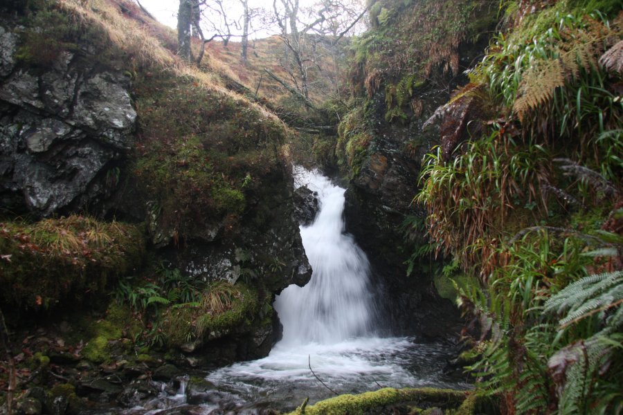 Small waterfall on the right branch.
 10 metre waterfall above it.
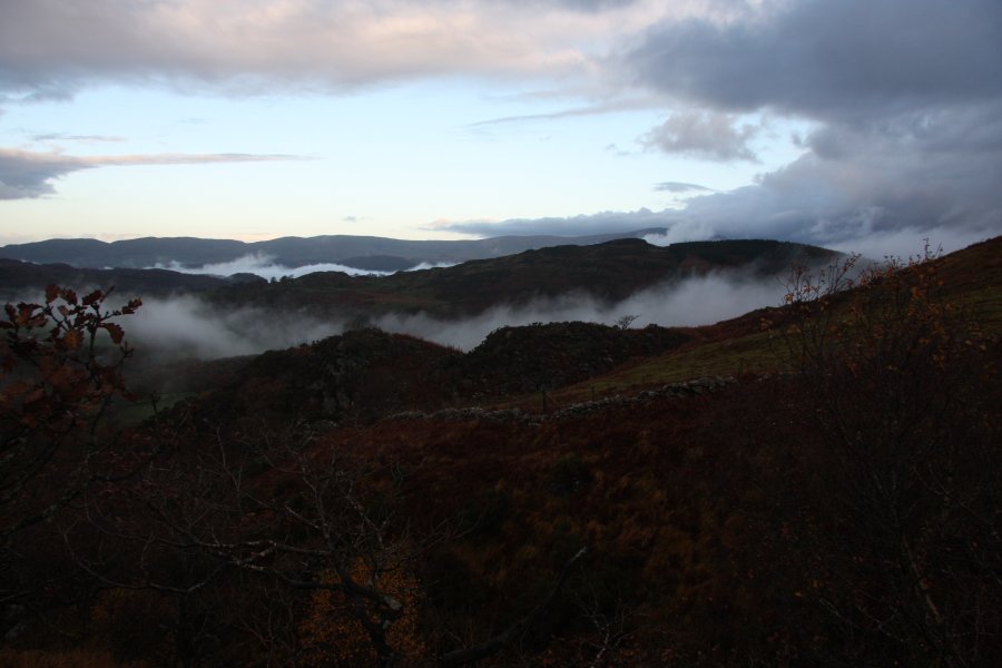 Inversion in front of the Rhinogydd ridge.
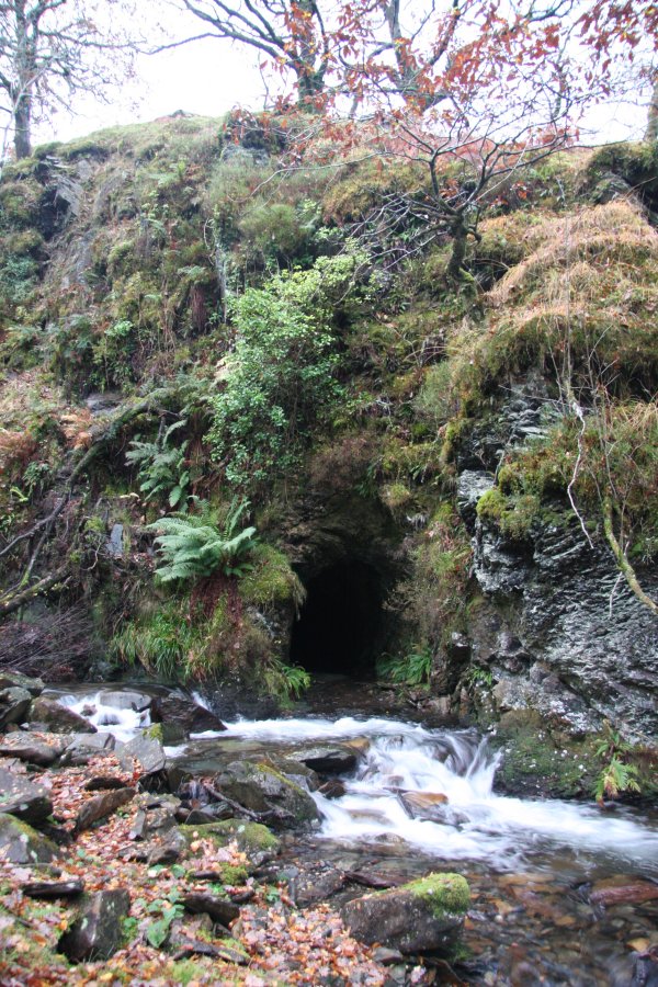 If you know what you are doing, there is another way back from here; at the stream junction, there is a mine adit.
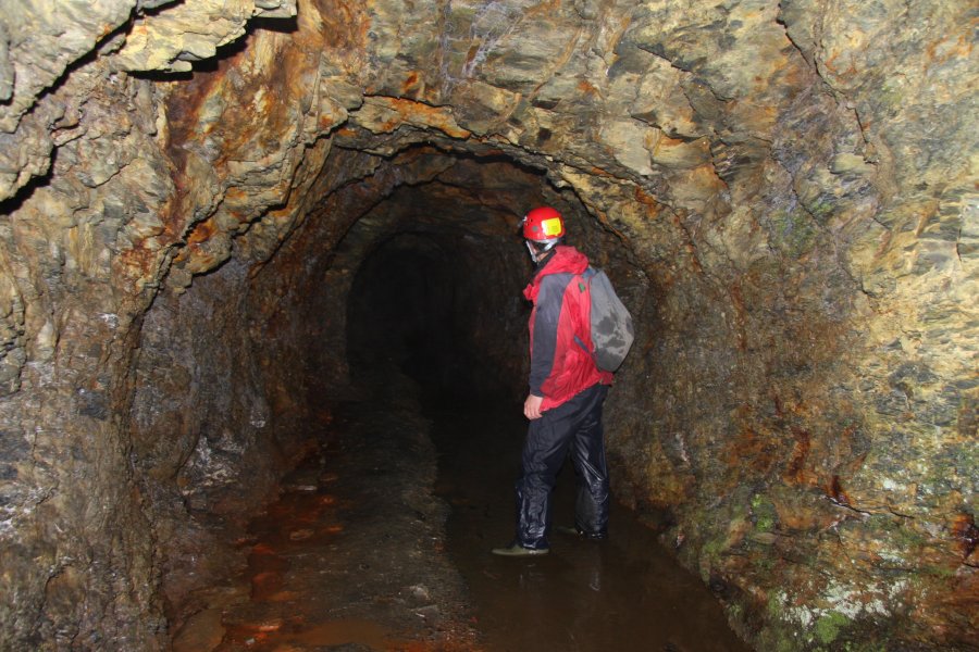 Roughly 40 metres long.
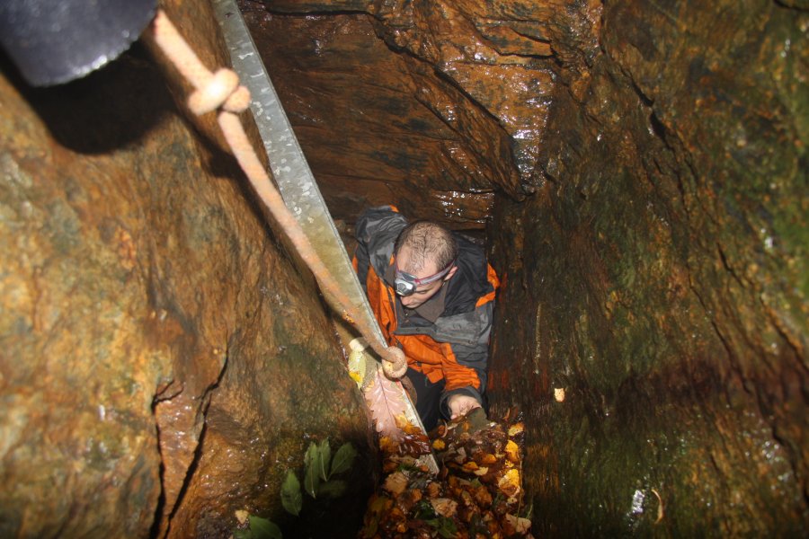 The end is choked, but cavers can scramble up into the bottom of the deep quarry. A path leads around the left side of the quarry and down to the quarry buildings.
 Another path leads above the stream, where just upstream is the final waterfall, also around 10 metres tall.
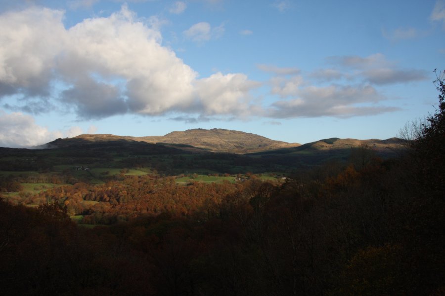 The extinct volcano Rhobell Fawr (734 metres) in the Arenigau.
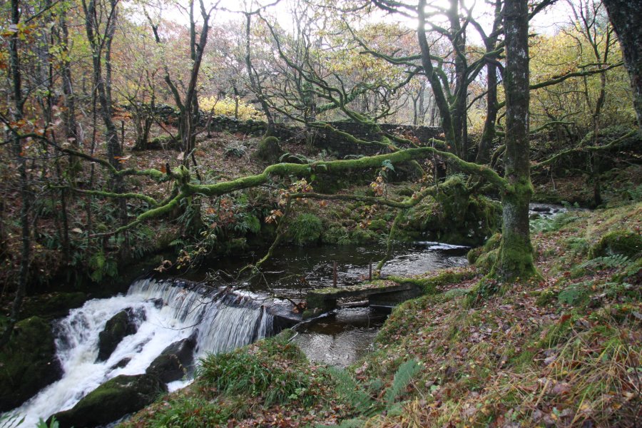 Immediately below the road is a small weir, which was previously used to feed a turbine.
 Twin waterfalls just below the weir.
 Immediately below is the next waterfall, and concealed by a tree is an iron ladder, which can be used to reach the remains of a turbine at the base. However, this ladder has suffered significant damage, and is not an official aid. You use it entirely at your own risk.
 Near the top of the ladder, a rockfall had severely bent it, with one rock lying on the ladder, wobbling but not removable. That was "fun".
 The waterfall, however, is quite spectacular in these high-flow conditions. 14 metres of thundering water.
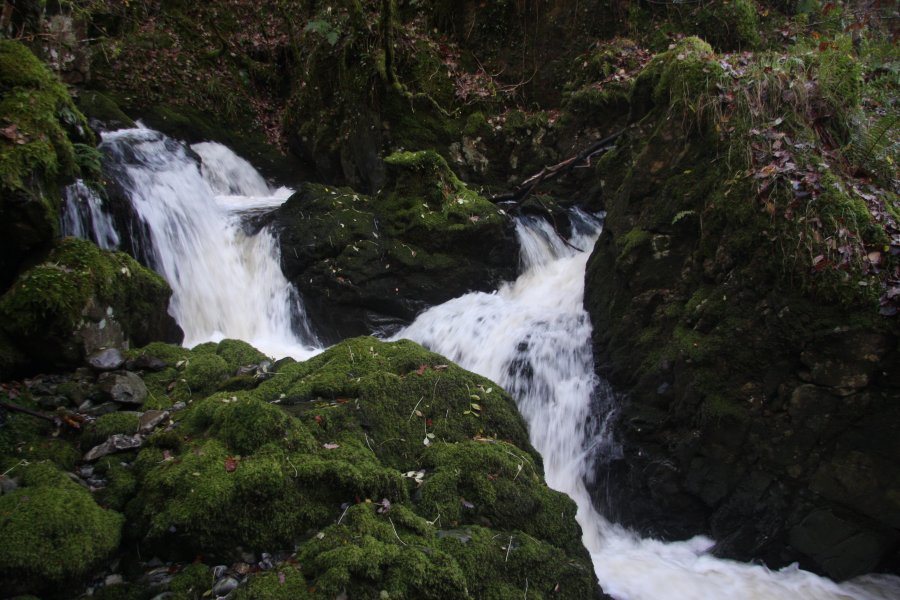 Cascades downstream.
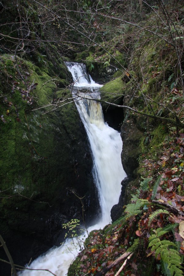 Cascades.
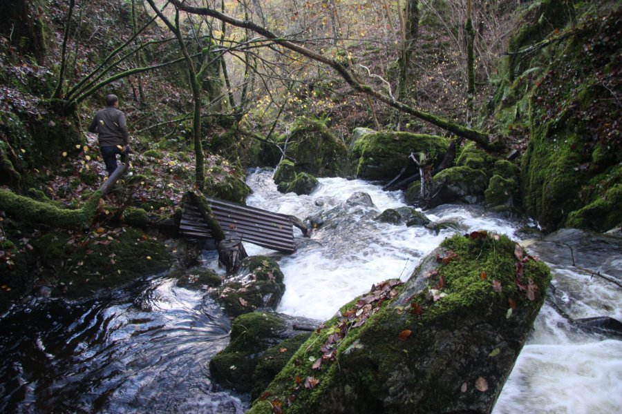 To get downstream, it is best to climb back up onto the bank, then locate an appropriate point to descend. We traversed the gorge wall, reaching a dislocated part of the ladder which had been placed to descend the bank.
 A tricky traverse back upstream then reached the bottom of the final waterfall.
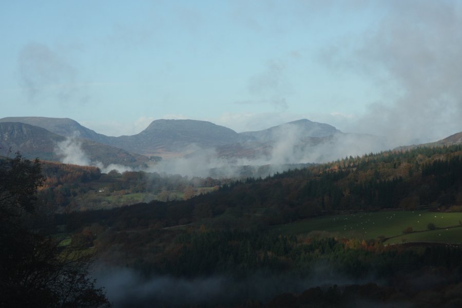 Superb view of the southern Rhinogydd range; crags of Y Garn, Y Llethr (756 metres), Rhinog Fach (712 metres) and Rhinog Fawr (720 metres).
 Llam yr Ewig and Pont Llam yr Ewig.
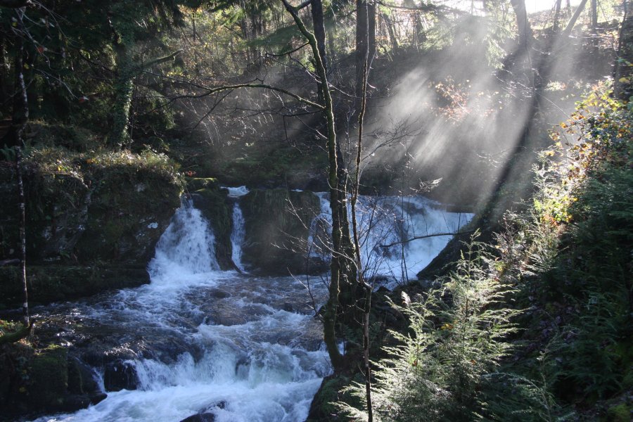 Misty light on the cascade above the waterfall.
 The area has some great walks, including the Forestry Commission's "Forest Garden" (and Glasdir Mines) walk and the Precipice Walk, and the waterfalls are conveniently located as a starting point. The Glasdir Copper Mines were known for the development of the "flotation" method of recovering copper from waste material.
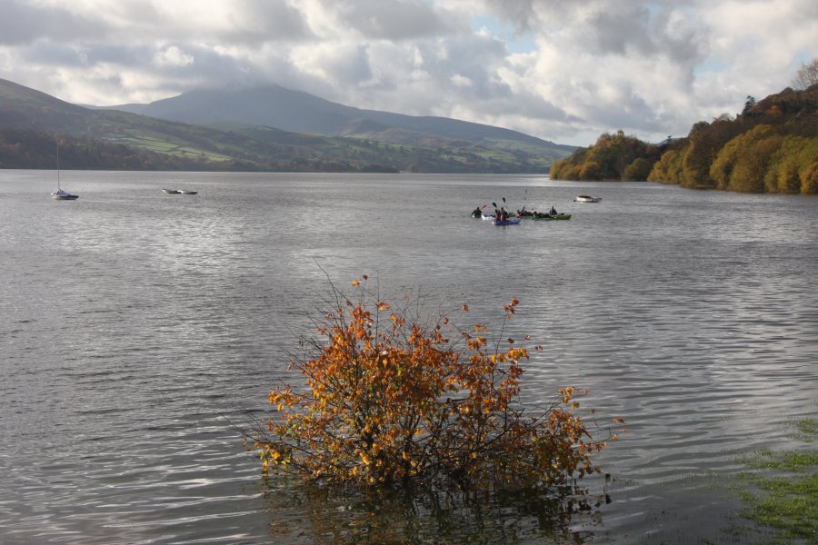 Llyn Tegid in high water at Bala, overlooked by Aran Benllyn (885 metres).
 No Overnight Parking.
 This is how they deal with rule-breakers. You have been warned.
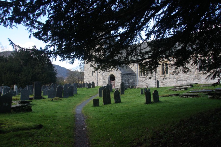 St. Melangell's Church, the focal point of the village, and the only dedicated parking area in the valley.
 Our route, which does not follow the routes in the guide, started by taking the nearby path into the Nant Trefechan valley. Only one of the three paths was marked at the farm, and to avoid irritating them, we took the wrong path (on the left of the stream) to get into the forestry, then made our way back to the path we wanted to take (on the right of the stream).
 Our path followed an old forestry track, climbing very steeply up the right side of the stream. After a couple of zig-zags, the track levelled out a little, with several fire tracks all joining together.
 We took the fire track up to the right, reaching a proper track running along an almost flat ridge. This took us slowly up to the edge of the forestry.
 View over the lower part of Cwm Pennant from Nant y Saer.
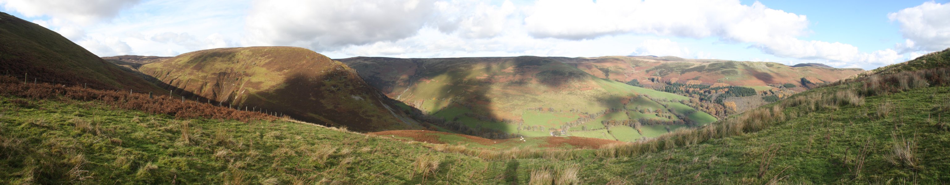 After locating the open access land, the route began to descend into the Nant Achlas valley. On the left is Cyrniau Nod (667 metres), and on the ridge beyond the far side of the valley is Post Gwyn (665 metres), with some of the main Berwyn tops behind it.
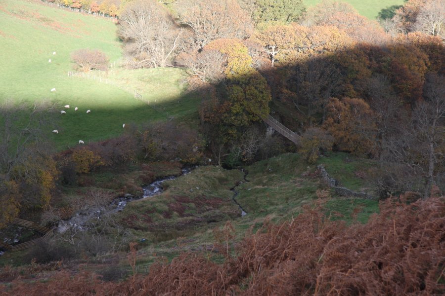 At the very edge of the open access land, the stream splits and rejoins, immediately before plunging down a waterfall. The stone wall and rope bridge mark the end of the open access land. The Tyn-y-cablyd owner has tried very hard to prevent visitors from approaching from the valley bottom (unless, it would seem, they are using the farm's holiday village), but thankfully, it can be seen from the bridge.
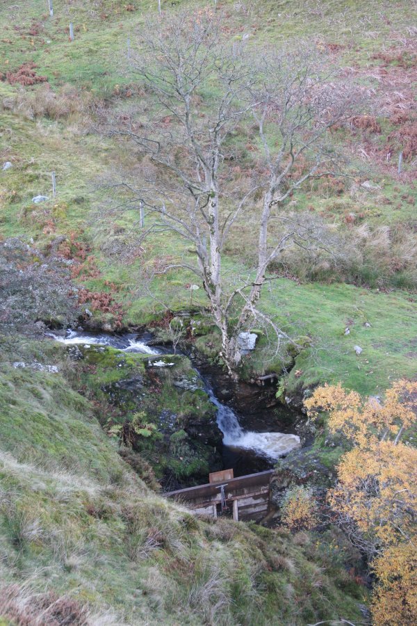 A small waterfall upstream has a small dam and sluice gate. The only purpose this seems to serve is to allow the water to be stored up, and sent down the main waterfall in a large pulse - a visitor attraction for holiday village guests, perhaps.
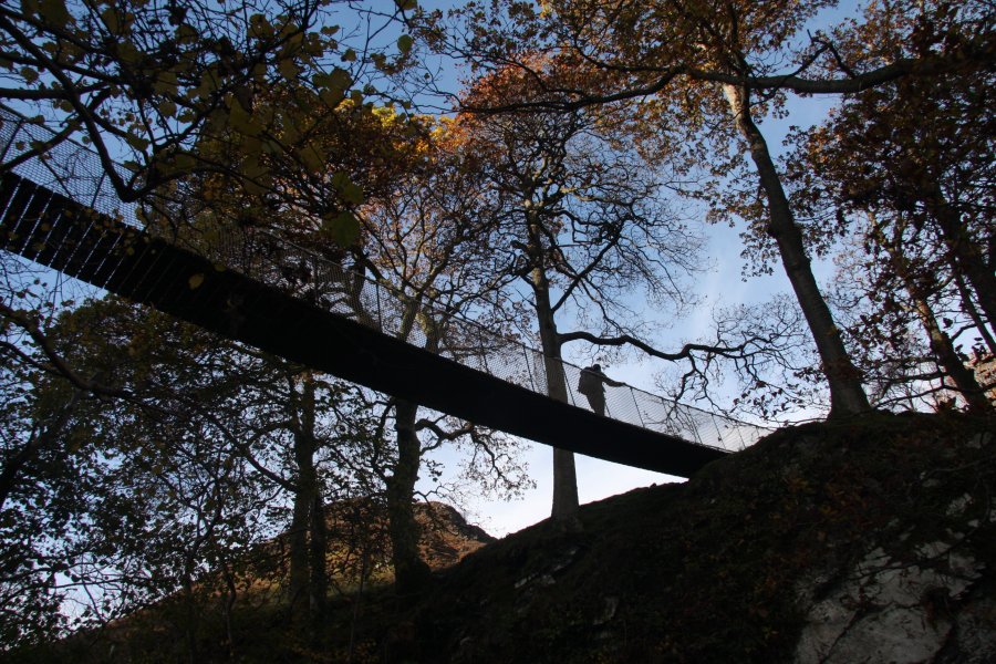 The rope bridge seems very well built, and we are not sure if it is official or not, but it leads through a private field, so it is best not to continue on the far side.
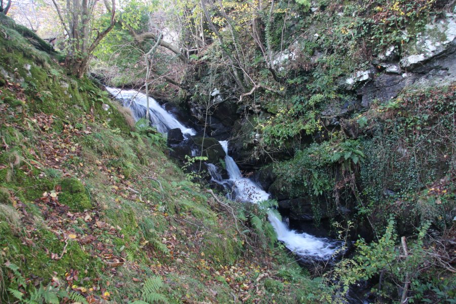 Pistyll Cablyd starts just upstream of the bridge, with this upper part dropping about 8 metres.
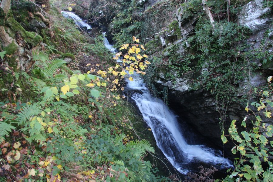 It continues under the bridge.
 It ends just downstream of the bridge, having dropped a total of about 14 metres.
 Not wanting to hang around on the edge of the private land, we returned back up to the edge of the fields on the far bank of Nant Achlas. A path running along the edge then dropped us into Cwm Pennant, where we continued to the head of the valley.
 A dog (which we assume belonged to the farm) appeared at the waterfall, and adopted us for the rest of the walk, determined that we must be responsible for it. It appears to be a Scottish deerhound, and certainly was as fast as one.
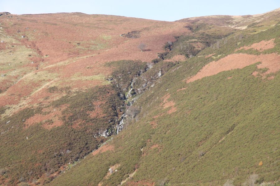 Nant Pen Cerrig dropping down some small waterfalls on the far side of the valley.
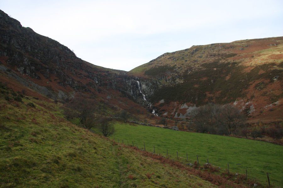 The fields finally end at the head of the valley, under its largest waterfall.
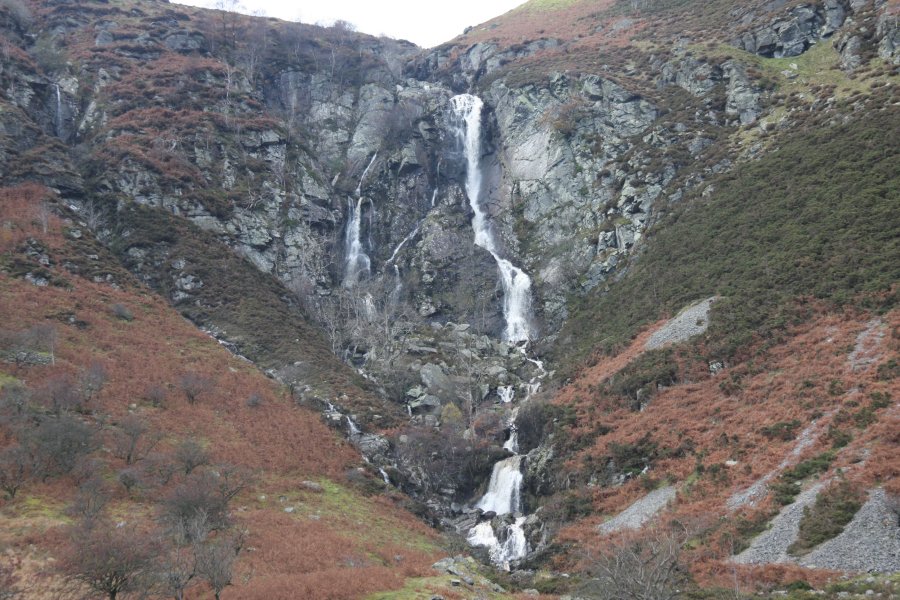 This is Pistyll Blaen-y-cwm, 107 metres in total, with the largest drop being 30 metres. The waterfall has a distinctive character, with ledges and cracks splitting the water into multiple strands. The one on the left manages to drop for a little over 15 metres in a single step.
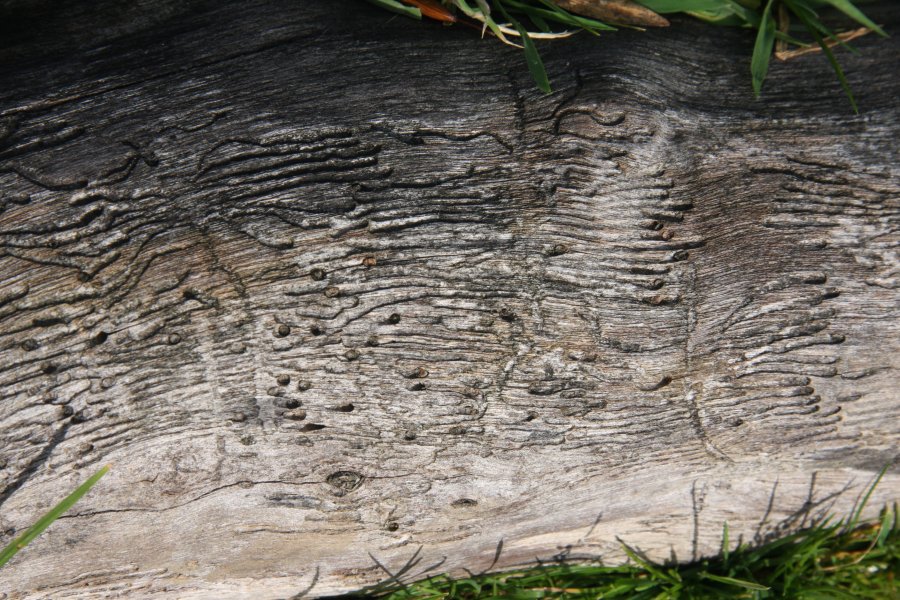 Woodworm.
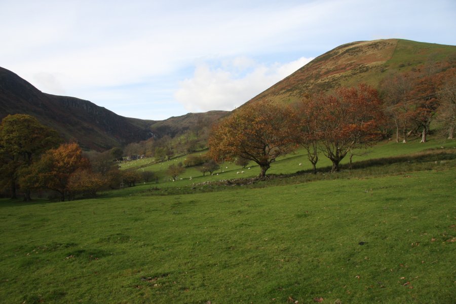 Our route followed the tops of the fields again, down the far side of the river, eventually dropping to the road through fields on a public right of way (one that is properly maintained, for once).
 While heading back along the roads towards Bala, the Afon Eirth Falls appeared at the head of Cwm Rhiwarth. These drop around 20 metres in total, with the tallest single drop being about 8 metres. These do not have any official name, and are simply named here after the river. Several other small streams in the valley have waterfalls, but none are very big, and none have names.
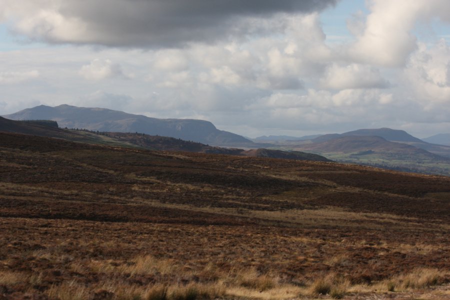 Arenig Fawr (854 metres), the tallest of the Arenigau.
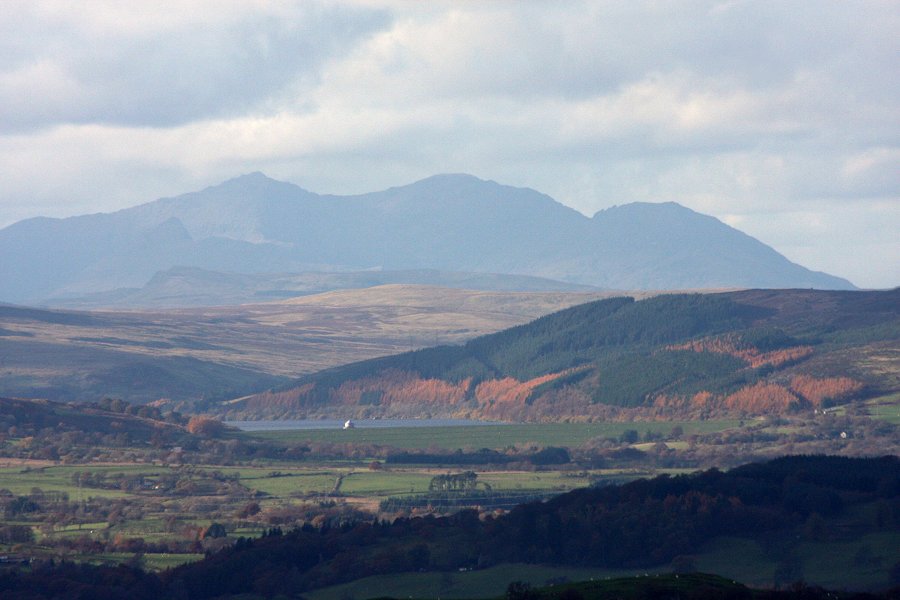 The Snowdon Horseshoe; Y Lliwedd (898 metres), Yr Wyddfa (1085 metres), Garnedd Ugain (1065 metres) on the Crib y Ddysgl ridge, and Crib Goch (923 metres).
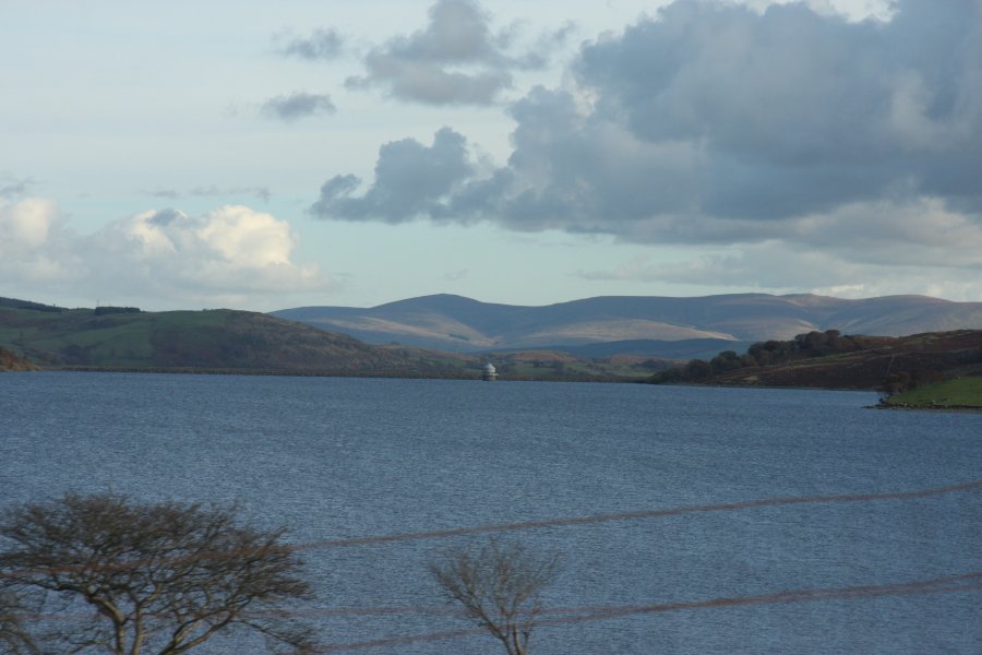 Llyn Celyn, the infamous reservoir established in the 1960s on the Afon Tryweryn, flooding the last Welsh-only speaking community in Wales. It was constructed to supply the English city of Liverpool, after the proposal was ratified by a parliamentary vote. 35 of the 36 Welsh MPs took part in the vote, and all of those voted against the plan. However, they were outvoted by the more numerous MPs from England. This incident showed the lack of Welsh power to control their own country, and was heavily influential in the establishment of the Welsh Assembly.
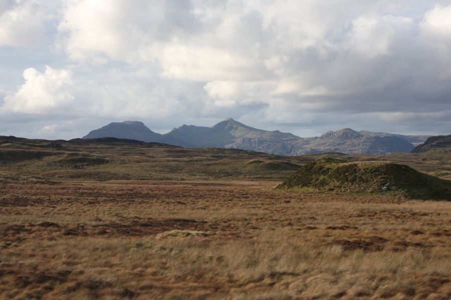 Approaching the Moelwynion range; Moelwyn Bach, Craigysgafn (689 metres), Moelwyn Mawr (770 metres), Moelwyn Mawr North Ridge Top (646 metres) and Moel-yr-hydd (648 metres), with Cnicht (689 metres) behind them.
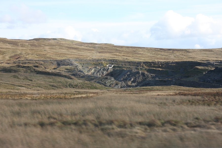 Quarry by Moel Llechwedd-gwyn.
 Nant y Pistyll-gwyn, seen from the road. The waterfall lies in the centre of the picture.
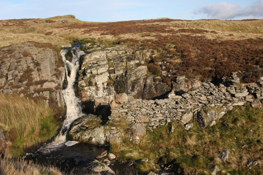 Pistyll Gwyn, a waterfall sharing its name with several others in the area, including one just on the other side of the Arenigau. This one is only about 6 metres tall.
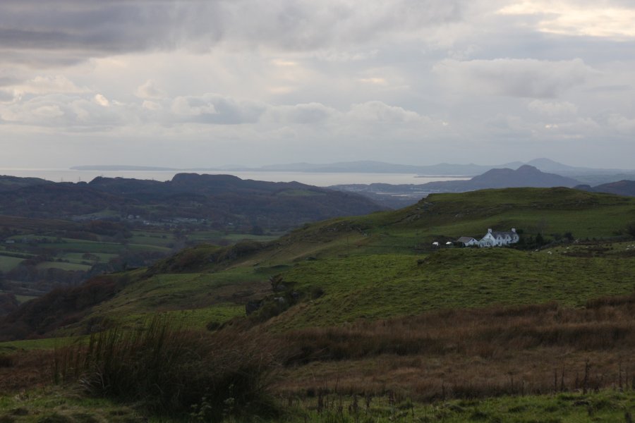 View of Porthmadog from a tiny car park on the side of the B4391, on the way to Llan Ffestiniog.
 Rhaeadr y Cwm, seen from the nearby viewpoint. About 80 metres in total (a few drops are not visible in this picture), with the tallest drop being 20 metres.
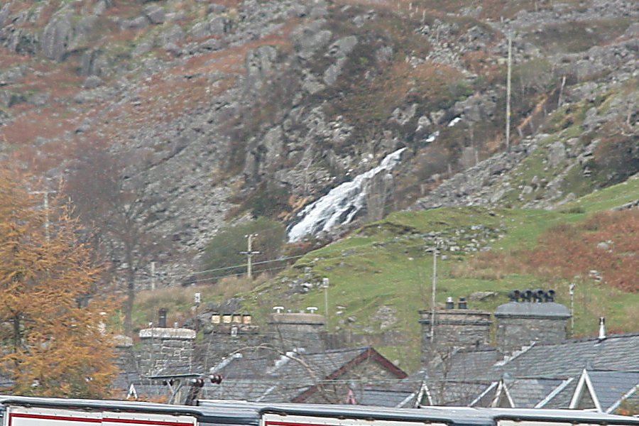 Distant view of the Afon Du-bach, seen over Blaenau Ffestiniog. The fairly short waterfall only gets attention because of its location.
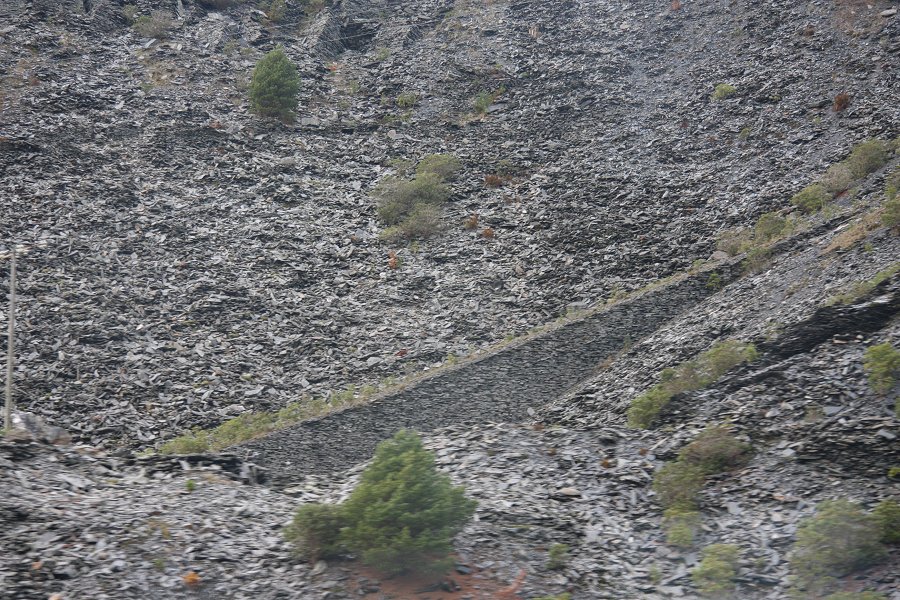 Immense tips of discarded slate at Llechwedd.
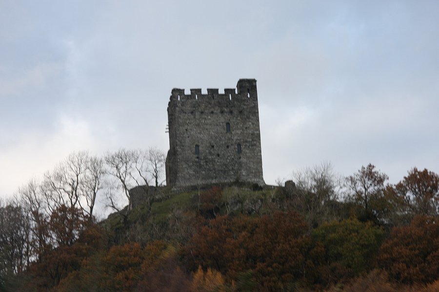 Castle Dolwyddelan at Dolwyddelan. In the village centre, take the side road heading south through the village, beside several churches and a pub. Cross a bridge, take the right fork then right turn to cross the next bridge. The lane then heads into Cwm Penamnen.
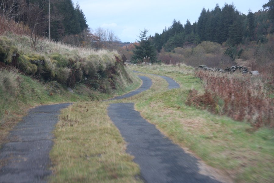 The lane follows Sarn Helen, a long roman road that can be traced all the way down to the Brecon Beacons in South Wales.
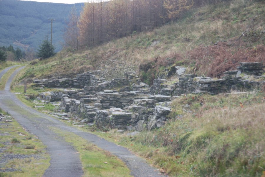 Tai Penamnen, the remains of a village. There is some limited parking at some picnic tables just beyond this, which is the only good place to park in the whole valley.
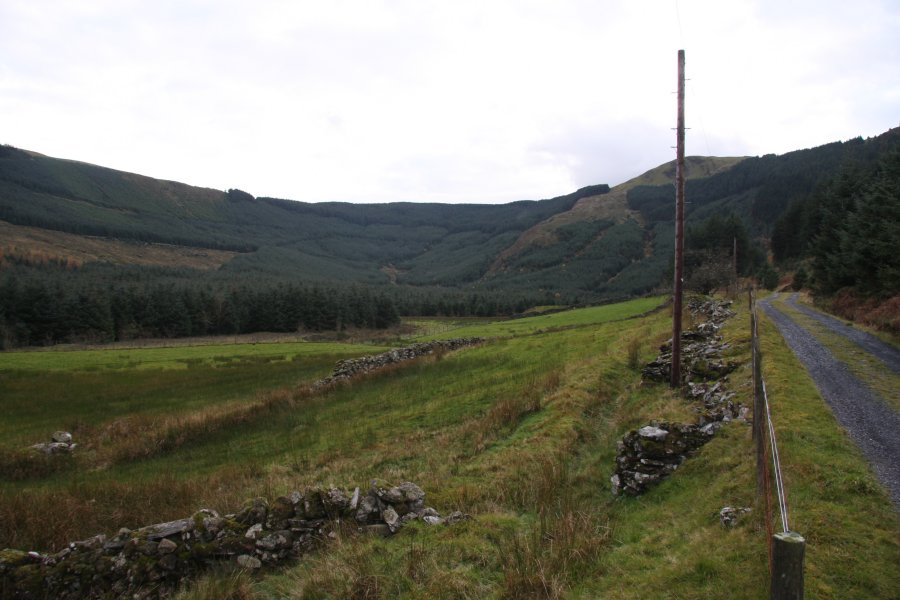 Walk down the lane, which soon becomes a dirt track. After passing through the garden of a cottage, the waterfall comes into view. If you want a longer walk, return on the other side of the valley, and locate the footbridge that returns you to the parking area.
 The Afon Maesgwm, on the right side of the valley, tumbles from a shallow valley down a series of waterfalls called Maesgwm.
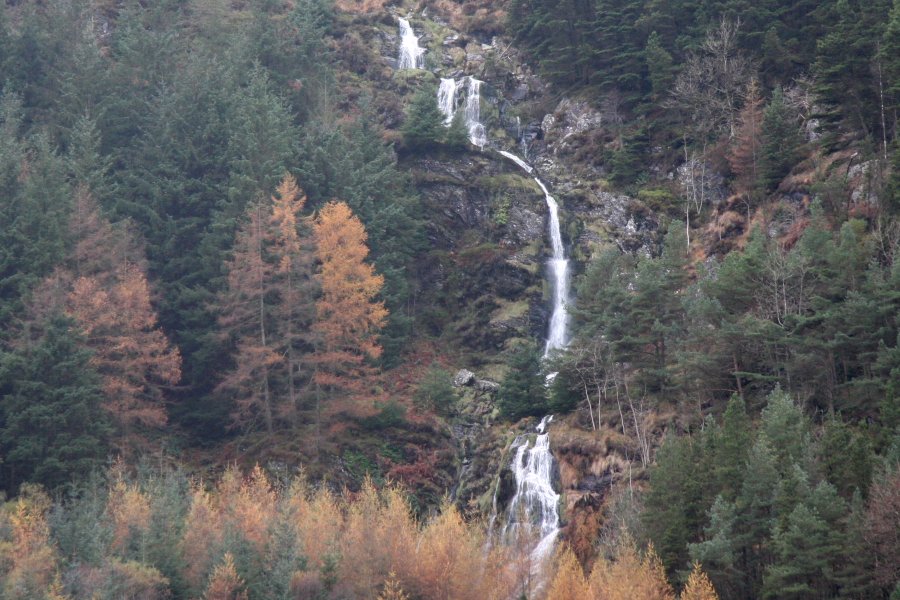 The tallest drops are a little over 10 metres, but careful reading of the maps shows that the total drop is an impressive 100 metres.
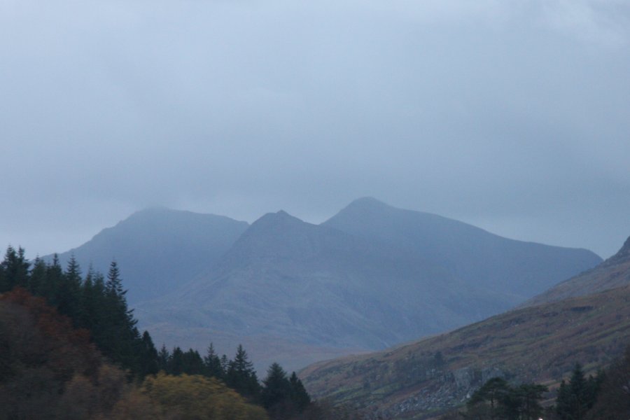 A hazy view of Snowdon's Yr Wyddfa, Crib Goch and Garnedd Ugain from Capel Curig. Why does this mountain never give me a clear view of its two tops when I am close enough to see it properly? Don't answer that.
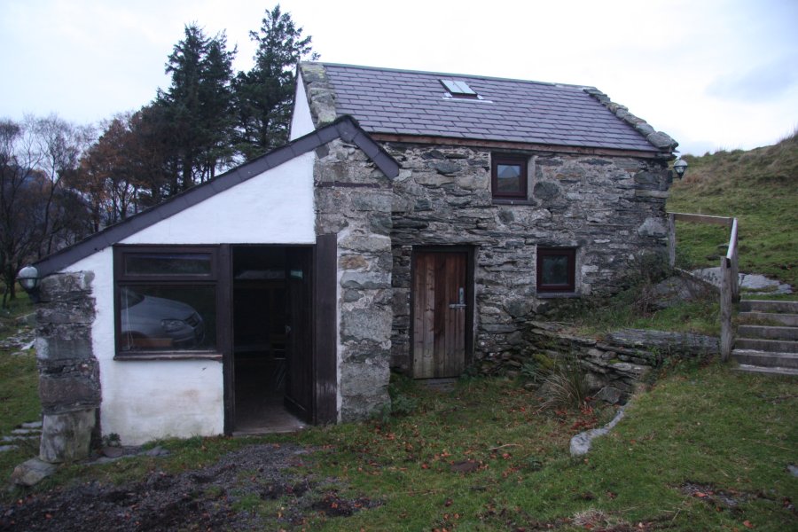 After a late change in bookings, we settled into an overflow bunkhouse nestled in the hillside, with a terrible access lane, spider-filled toilet that smelled like a chicken coop, outdoor sink-without-plumbing, and pretty much nothing else.
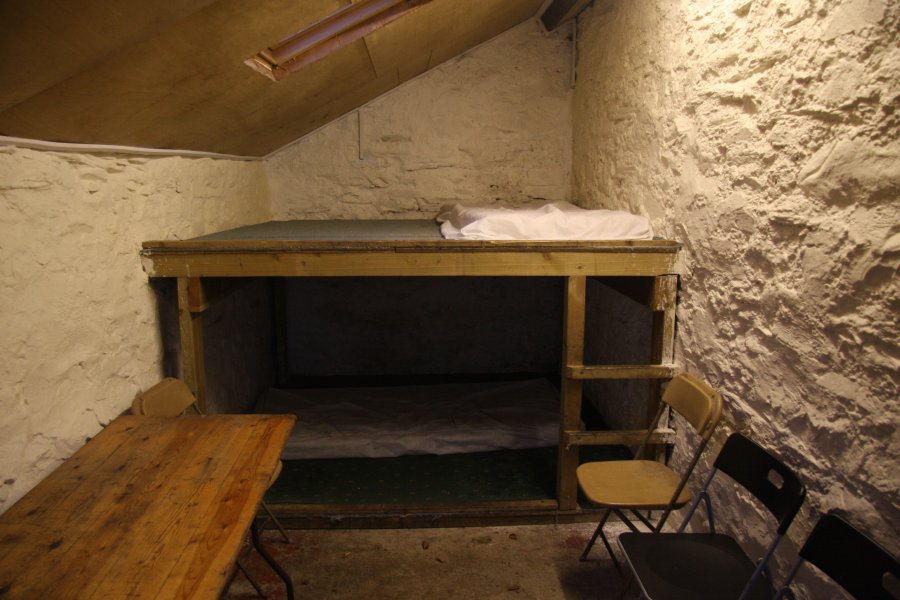 There was a gas stove and rusty saucepans though. But hey, aside from the cold and dirt, this has to be one of the greatest bunkhouses in Snowdonia. An experience instead of a 5 star hotel.
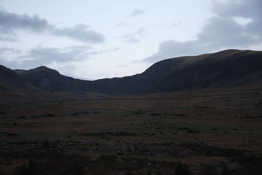 Carnedd Llewelyn (1064 metres) and Pen yr Helgi Ddu (833 metres), somewhere above our bunkhouse.
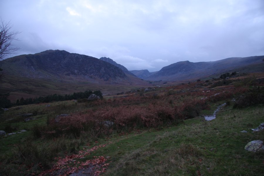 And the superb view of the mountains surrounding the Llugwy/Ogwen valley, seen from our bunkhouse; Gallt yr Ogof (763 metres), Tryfan (917 metres), Foel-goch (831 metres), Pen yr Ole Wen (978 metres) and Carnedd Dafydd (1044 metres). That night, the sleet poured...
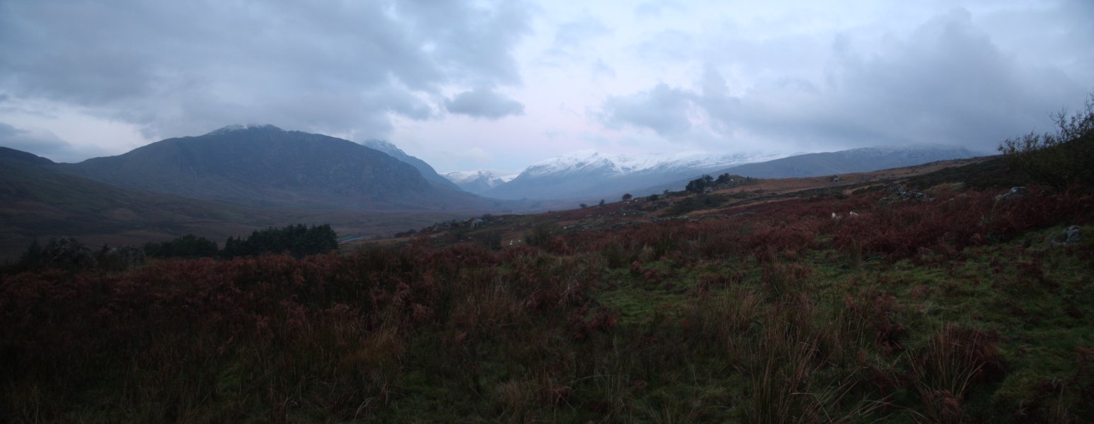 By morning, the mountain tops had been transformed. Same mountains as before; Gallt yr Ogof, Tryfan, Foel-goch, Pen yr Ole Wen and Carnedd Dafydd.
 Foel-goch, Pen yr Ole Wen and Carnedd Dafydd.
 Red sky in morning, means a great day, right?
 Could I ask for better?
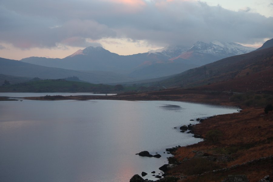 The Snowdon massif over Llynau Mymbyr. Visible are Gallt y Wenallt (619 metres), Lliwedd Bach (818 metres), Y Lliwedd East Peak (893 metres), Y Lliwedd and Crib Goch. The main tops are, of course, missing.
 Crib Goch seems to have grown by 1000 metres or so overnight.
 The back of the Glyderau ridge was also dusted white, but sadly with a cloud cap.
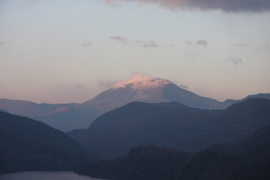 Moel Hebog (782 metres) with its own personal snow cloud.
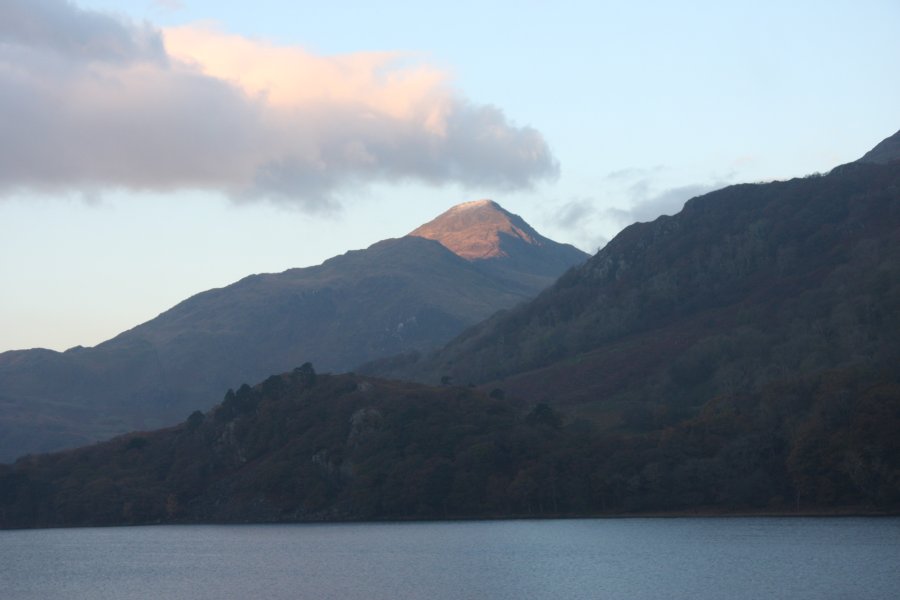 Yr Aran's 747 metres had been just enough to snag some snow as well.
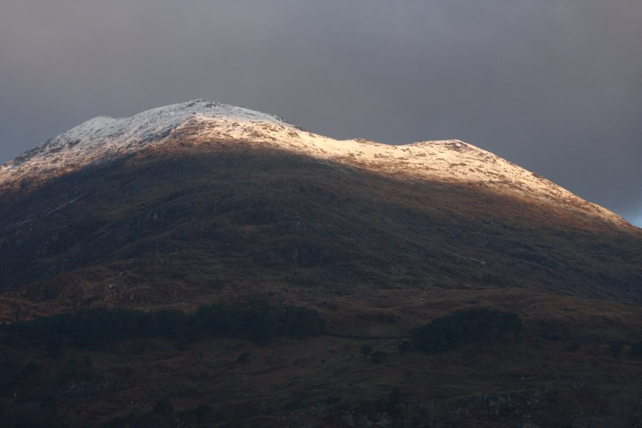 Snow and sunrise on the back of Y Lliwedd.
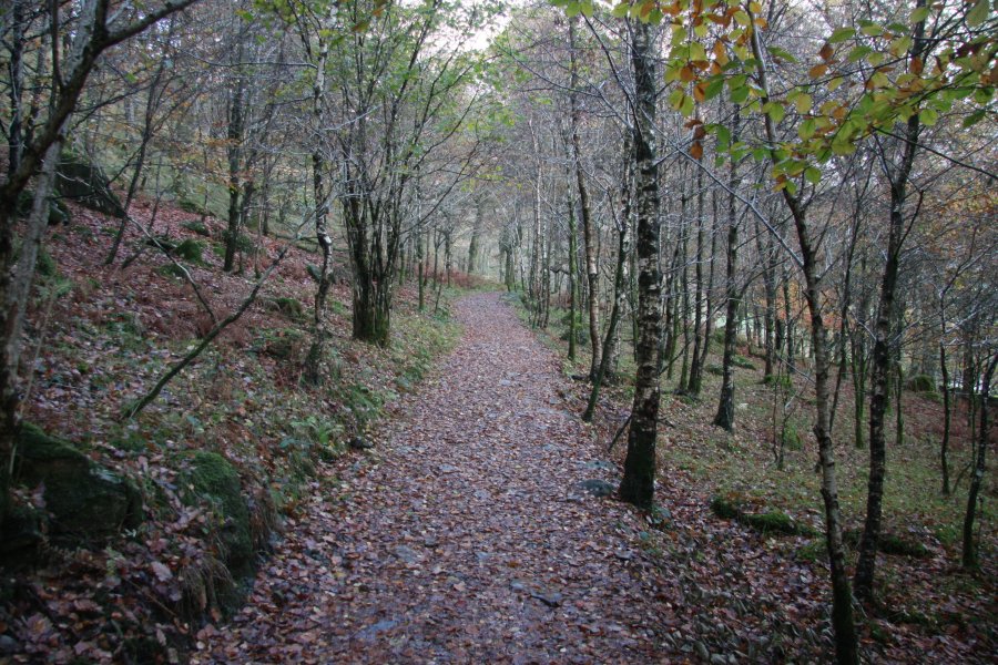 The waterfalls are easily reached by following Snowdon's Watkin Path from Nantgwynant.
 One of the local goats helping to keep the undergrowth in check, and simultaneously making the mountainside smell distinctively musky.
 Remains of the old tramway incline.
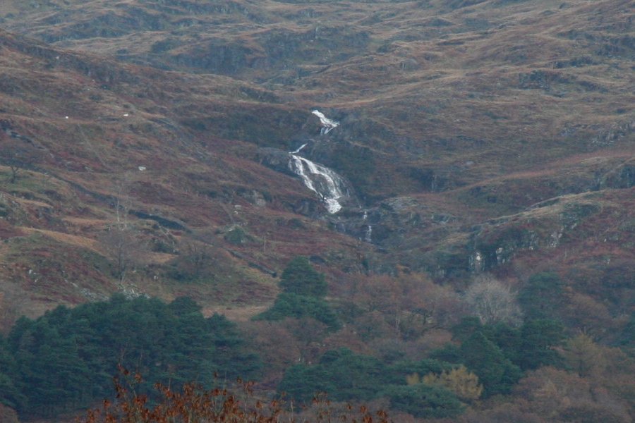 Cascades on the Afon Merch, on the back of Gallt y Wenallt. These can be clearly seen from the Watkin path, but are not actually very tall - less than 20 metres in total.
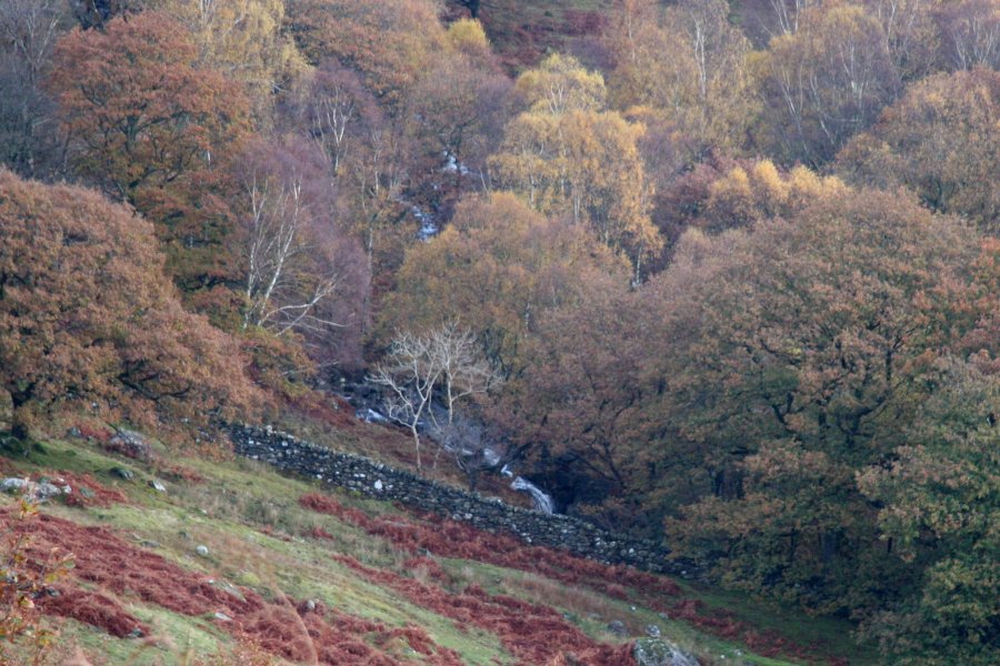 At the bottom of the valley, the same river produces some more noisy cascades.
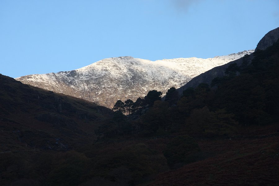 Then we step out of Wales and into the Himalaya. This superb view is of the Bwlch Maen ridge leading up to Snowdon - the top of which is just hiding off to the right.
 As the path reaches the first bench of Cwm Llan, the waterfalls come into view. This was used as the filming location for the Khyber Pass in the 1968 film; Carry On... Up the Khyber. The border gate in the film was located just above the left side of the waterfall.
 The waterfalls are about 30 metres tall in total, dropping in several steps, the largest of which is about 10 metres tall.
 Yr Wyddfa, the top of Snowdon, has now just come into view, but we're heading elsewhere.
 Light and lumps on Y Lliwedd.
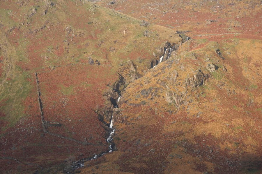 Tumbling out of Snowdon's horseshoe is Rhaeadr Cwm Dyli. It drops a total of about 100 metres, and most of that can be clearly seen from the A498 Snowdon viewpoint.
 The largest drop is only about 10 metres.
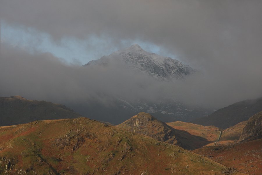 Then at long last, Snowdon decides to let me see the Yr Wyddfa top, and its immense 480 metre cliff. The window in the clouds is such a beautiful effect. (For the sake of honesty, I have to admit that this is a composite picture, made from a couple of lucky shots taken from a moving car - one showing the left crags, and one showing the right crags. The originals were not too dissimilar, but had damage caused by motion blur, and clipping caused by the clouds.)
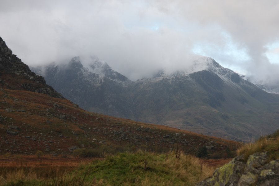 Just in case we had not already been lucky enough, the Glyderau gave us a spectacular welcome at Y Garn (947 metres), with cloud in the hanging glacial valley appearing to be smoke from an active volcano.
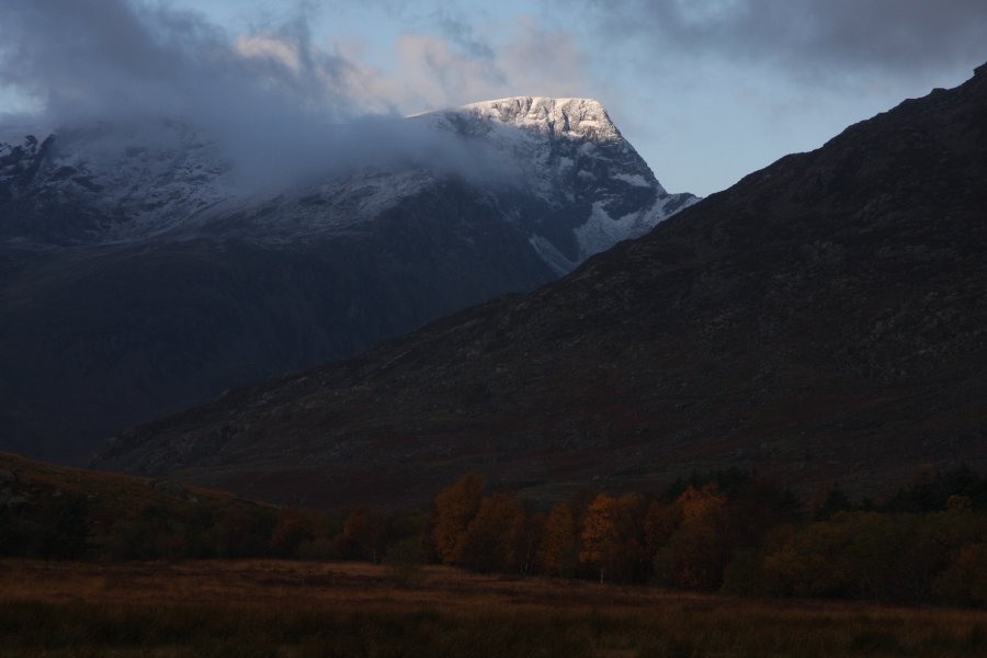 Superb light and snow on Foel-goch.
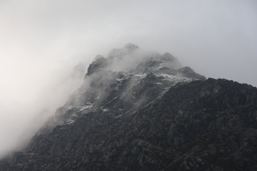 Clouds peeling off Tryfan.
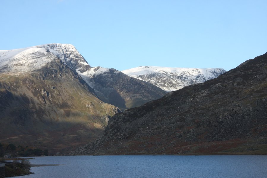 Foel-goch and Mynydd Perfedd (812 metres) over Llyn Ogwen.
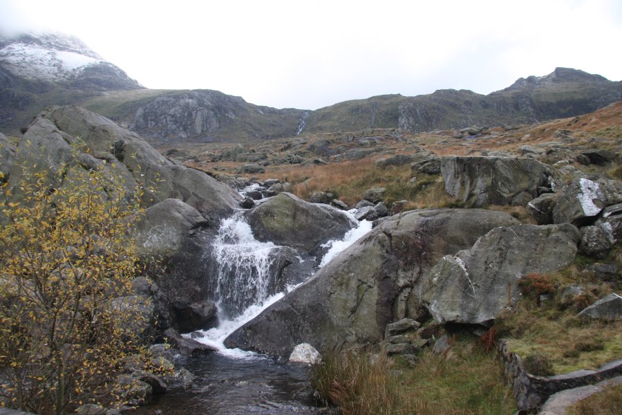 Passing Nant Bochlwyd.
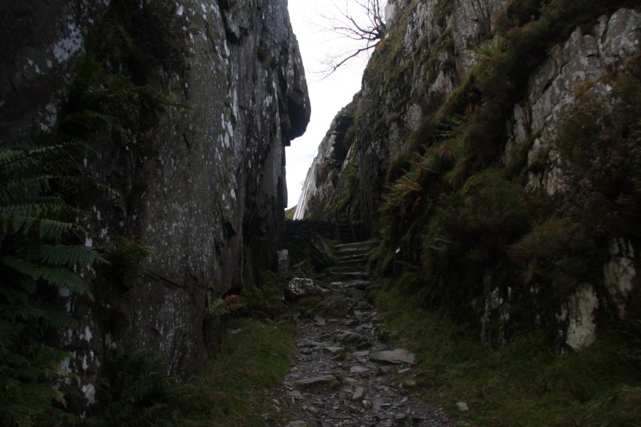 Our route starts at the Idwal Cottage. Rather than follow the usual path, we decided to take the less travelled route around Llyn Idwal, starting by heading up through the Idwal Slate Mine. For this walk, we were accompanied by two more friends, who coped admirably despite having been told to expect only a short walk.
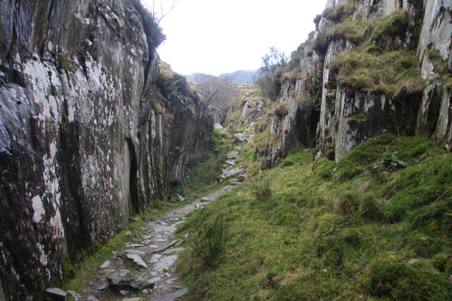 The mine is an open quarry, with an easy pathway.
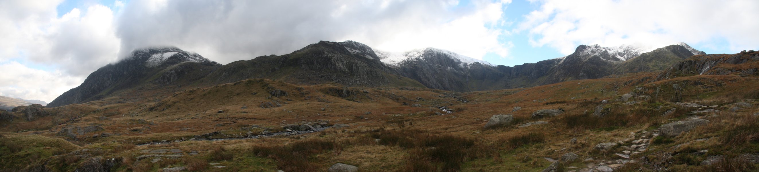 View from the end of Cwm Idwal; Tryfan, Glyder Fawr (1001 metres) and Y Garn.
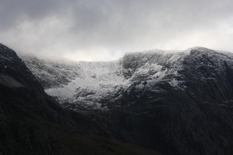 The Nameless Cwm/Cwm Cneifion, a massive hanging valley on Glyder Fawr.
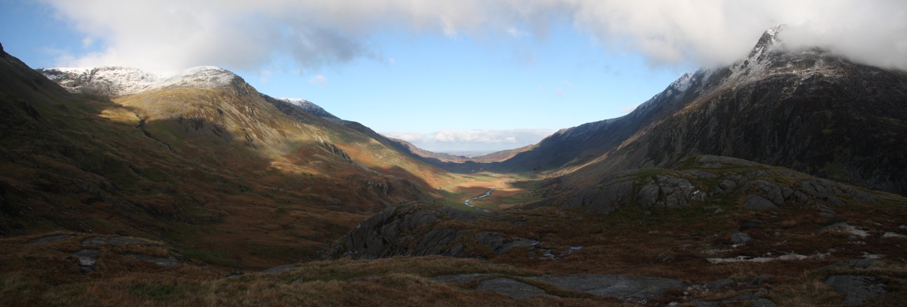 Nant Ffrancon, a huge glacial valley carrying the Afon Ogwen between Mynydd Perfedd and Pen yr Ole Wen.
 Carneddau Ponies, the northern branch of the wild Welsh Mountain Ponies, seen here on the flanks of Y Garn.
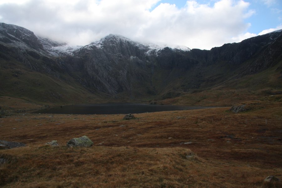 Llyn Idwal, surrounded by all of the waterfalls that we were here to see.
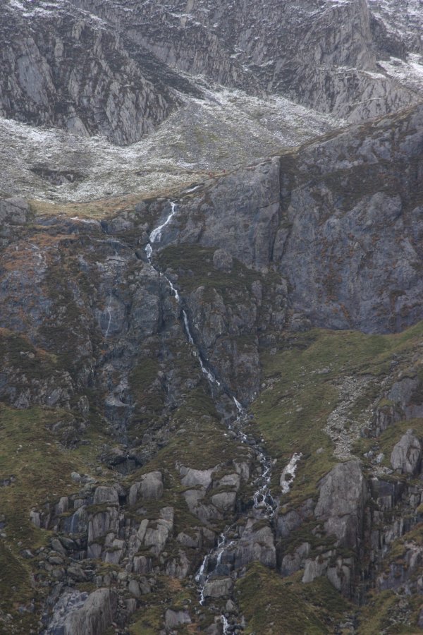 Falling out of Cwm Cneifion are some waterfalls without an official name, so I refer to them as Cwm Cneifion Falls. The total drop is about 63 metres, while the tallest single drop is about 12 metres. Though you probably cannot see them, there is a walker in blue at the bottom, and two walkers in red at the top.
 The most obvious inlet. This drops for some 300 metres over about 700 metres of horizontal distance, making this clearly just a very tall white-water stream (probably the tallest in Wales). The tallest actual waterfall parts of it add up to a little under 40 metres.
 Next is a black smudge which does contain a small horsetail waterfall, but the height of the tallest drop is significantly under 20 metres. Interesting, but not big enough to set any records.
 Next is the gorge of the Devil's Kitchen/Twll Du. On its right, the blackened wall is the Devil's Appendix waterfall, the tallest single drop waterfall in Wales, at 93 metres. In this low flow (even after the sleet), it is partially broken, but never stops dropping until it reaches the bottom.
 The Devil's Kitchen is an impressively deep gorge, dropping at a very steep angle. There are two waterfalls at its head, dropping a total of a little over 24 metres (according to climbing guides). The upper one (seen here) is about 20 metres in height.
 The gorge begins with a grade 1-2 scramble. This barres access to normal walkers.
 There are scrambles further up as well.
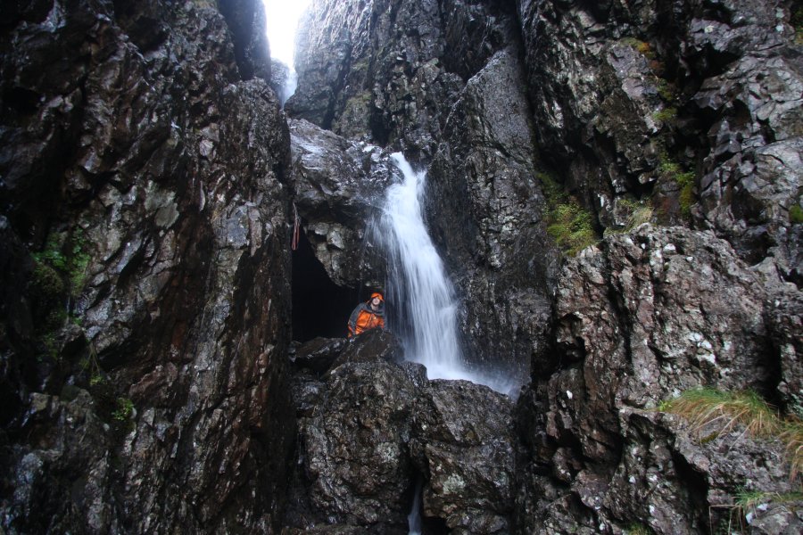 The first proper climb is known to climbers as the boulder overhang. It is made by a large, wedged boulder with plenty of space beneath it, which allows you to walk behind the waterfall - waterproofs are advised.
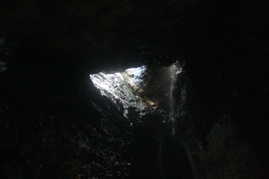 Inside the space, more water spills in from further holes behind the boulder.
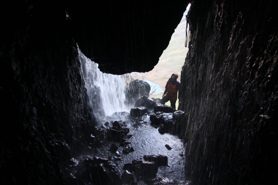 This gives a quite unique situation with a waterfall behind a waterfall. In addition, it is possible to walk behind that as well, meaning that you can walk behind the waterfall behind the waterfall (cue Mad Xzib). This is the only known waterfall in Wales where this is possible.
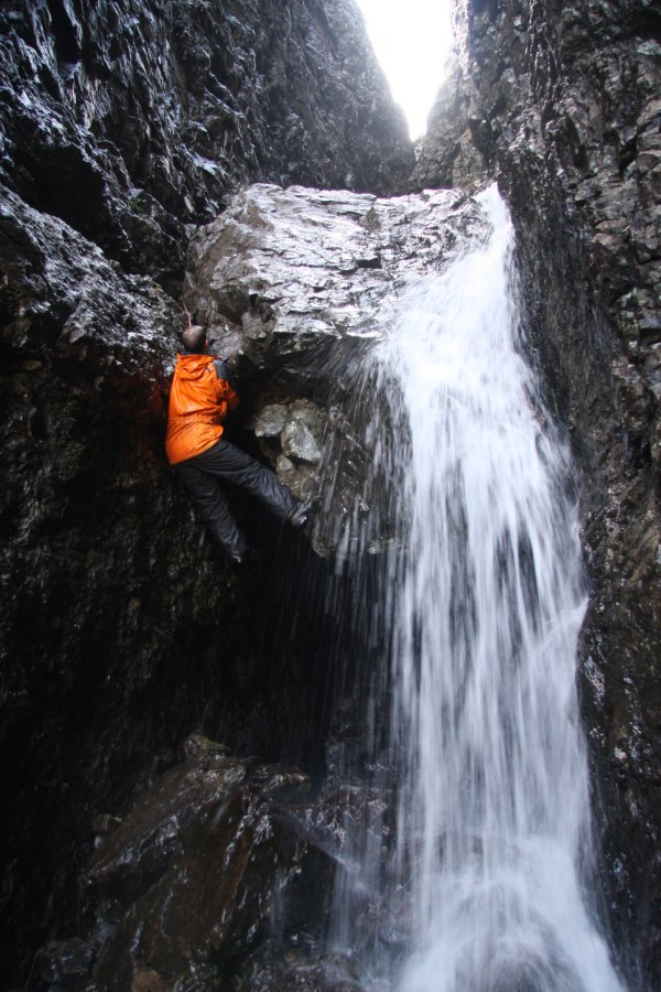 Getting beyond this point requires climbing skills and equipment, so we turn back.
 With the immaculate conditions, we could not resist, and decided to extend our little walk to a proper walk over the Glyderau. The stunning view from Cwm Cneifio (note the different spelling) should show why. Y Garn, Pen yr Ole Wen, Carnedd Dafydd, Pen yr Helgi Ddu, Pen Llithrig y Wrach (799 metres), Tryfan and Glyder Fach (994 metres).
 Gyrn Wigau (643 metres) and Drosgl (758 metres).
 Pen yr Helgi Ddu.
 By far the best picture I have ever taken of Tryfan.
 View over all of the less well known mountains of the Snowdon massif. On the near ridge is Llechog (718 metres), then behind that is the ridge containing Moel Cynghorion (674 metres), Foel Goch (605 metres), Foel Gron (629 metres) and Moel Eilio (726 metres). Behind them is Mynydd Mawr (698 metres) in the Moel Hebog range.
 The steps from the Devil's Kitchen may seem steep, but they are nothing compared with the slopes above the pass. Glyder Fawr is another 300 metres up over scree, and even with the snow there, it really dragged on.
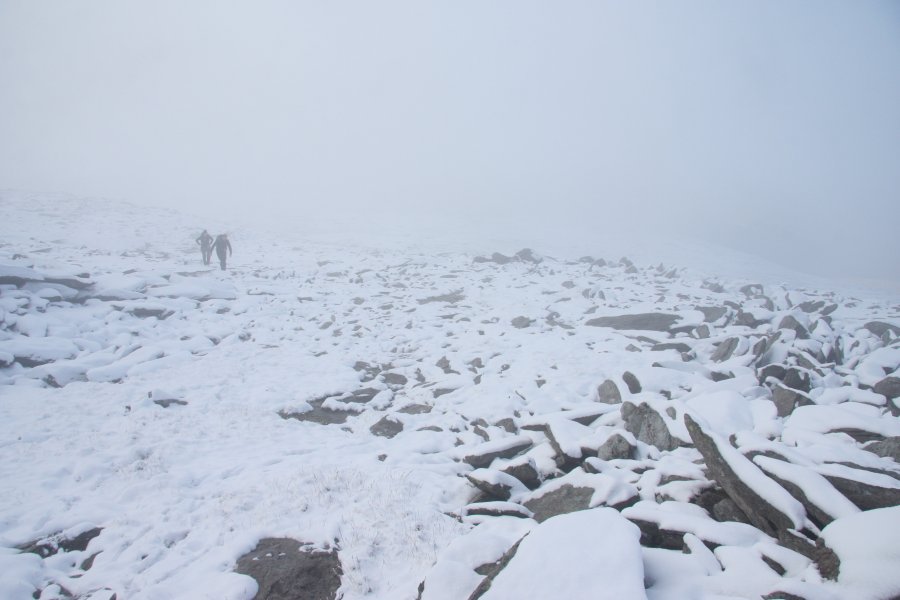 Sadly, the cloudbase dropped, so we lost the visibility, and continued up in the fog.
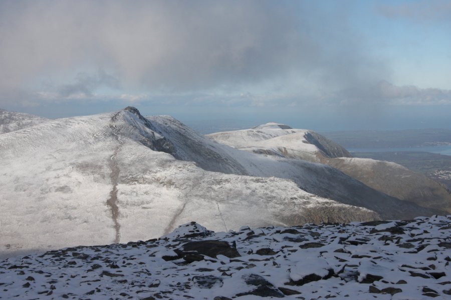 The northerg Glyderau; Y Garn, Foel-goch, Mynydd Pervedd and Carnedd y Filiast (821 metres).
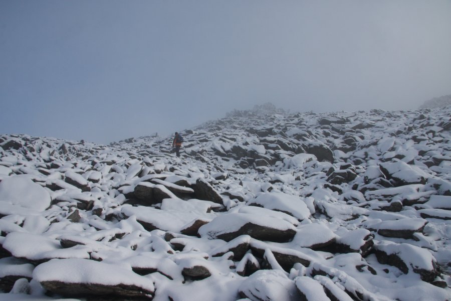 Approaching the Glyder Fawr top.
 Top of Glyder Fawr.
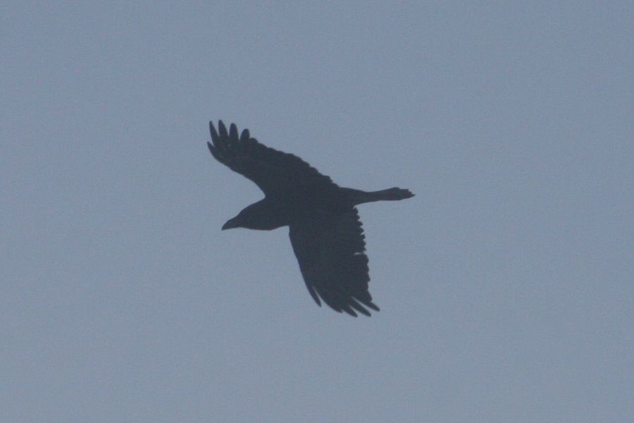 Raven flying through the fog. I wonder how they know where the crags are, and how often they accidentally fly into one.
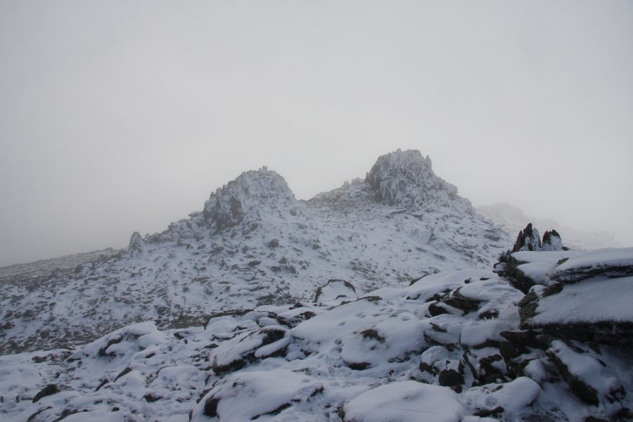 Other tops. The one on the right looks as tall as the main top.
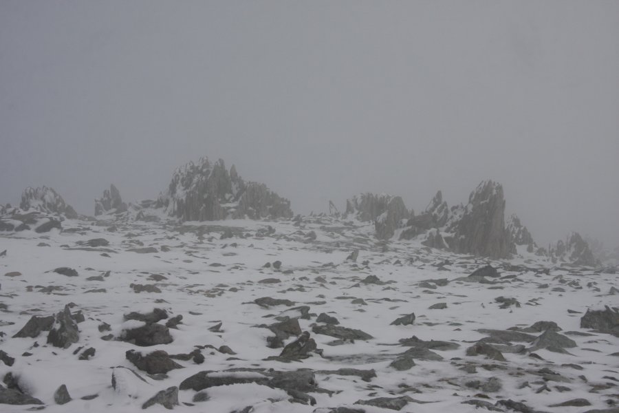 Alien landscape.
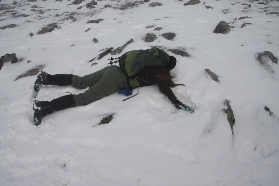 Perfect place to make a snow angel, right? Face down 'cos of the bag.
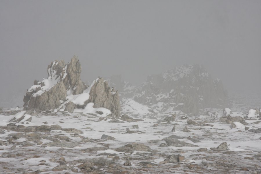 Outcropping spikes.
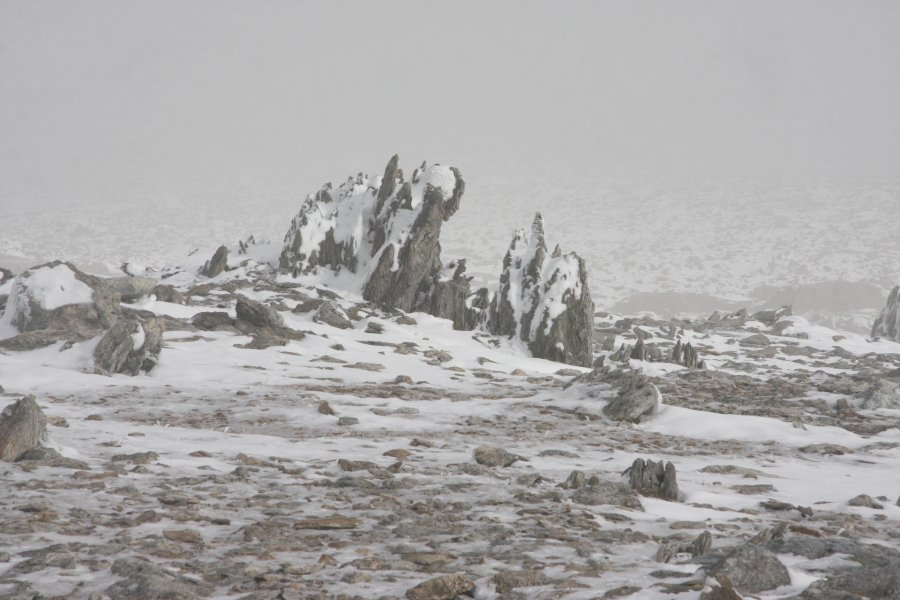 This one even has a face.
 Walking the cornice (no, not a real one...).
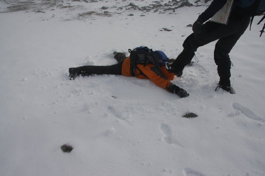 Time for another snow ang...urmphphp!
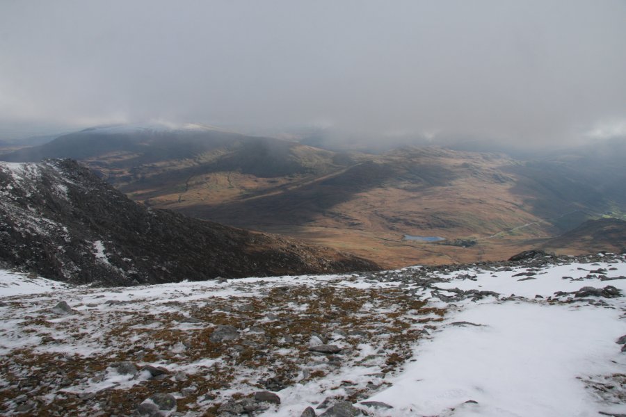 Moel Siabod (872 metres).
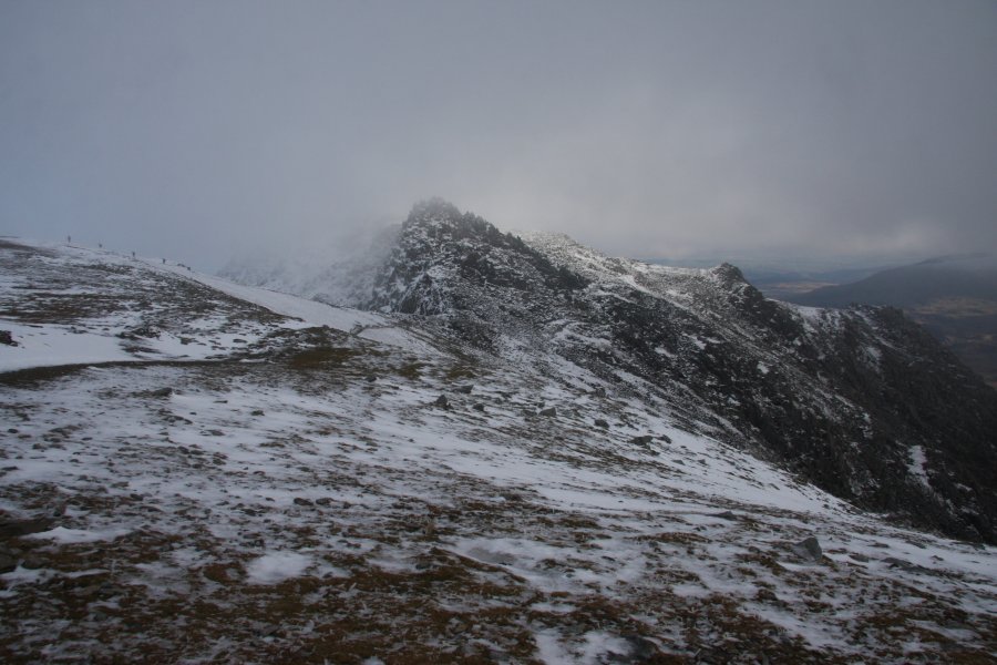 Castell y Gwynt (972 metres).
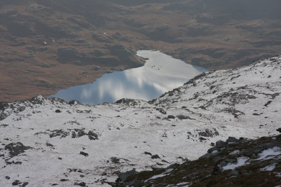 Llyn Cwmffynnon and reflections of a blue sky.
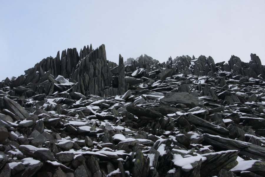 Spiked rock on Castell y Gwynt.
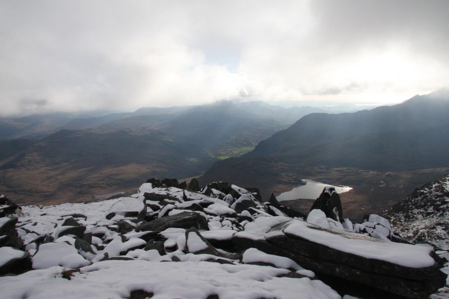 Moelwynion ridges with Y Lliwedd on the right. Visible are the Ysgafell Wen tops; Ysgafell Wen Far North Top (650 metres), Ysgafell Wen North Top (669 metres) and Ysgafell Wen (672 metres), with Cnicht to their right.
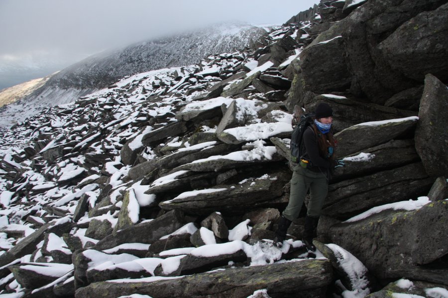 Skirting Castell y Gwynt, with no hint of a path. Immediately after taking this picture, Nikki dropped a child ... er ... a stuffed sheep called Syd, which had been tucked into her bag's straps, and didn't notice.
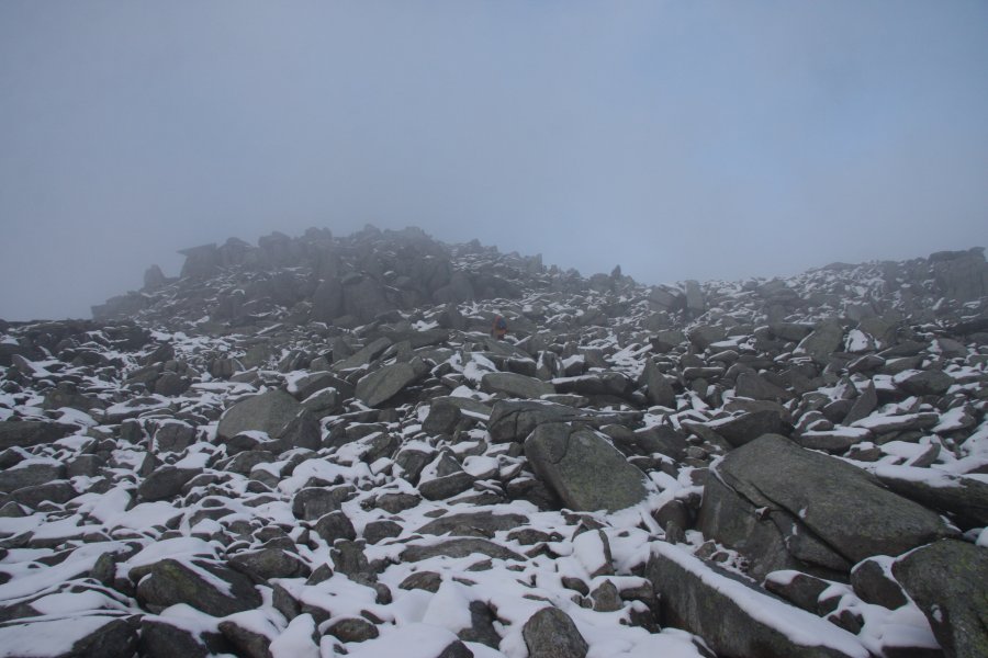 She noticed 300 metres later, just as we were approaching Glyder Fach, and so began the search - hey, at least with snow, you can see where you have been, but ... er ... why am I searching for this sheep?
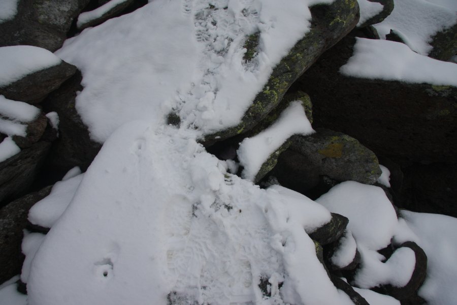 -300 metres later, and I gave up and turned back. Then realised that in that gap at my feet...
 ...There was a sheep. The law of probabilities says that this is impossible.
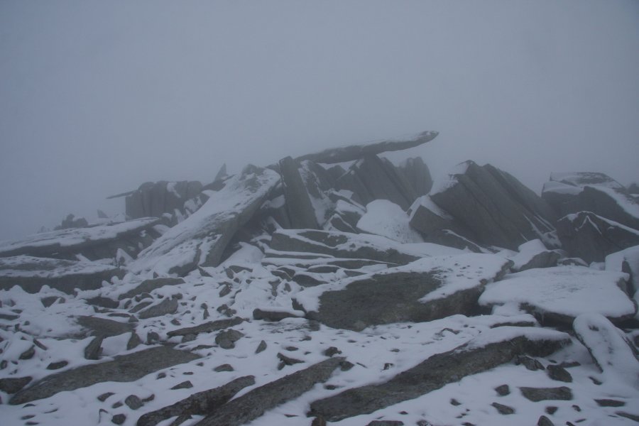 The cantilever, near the Glyder Fawr top.
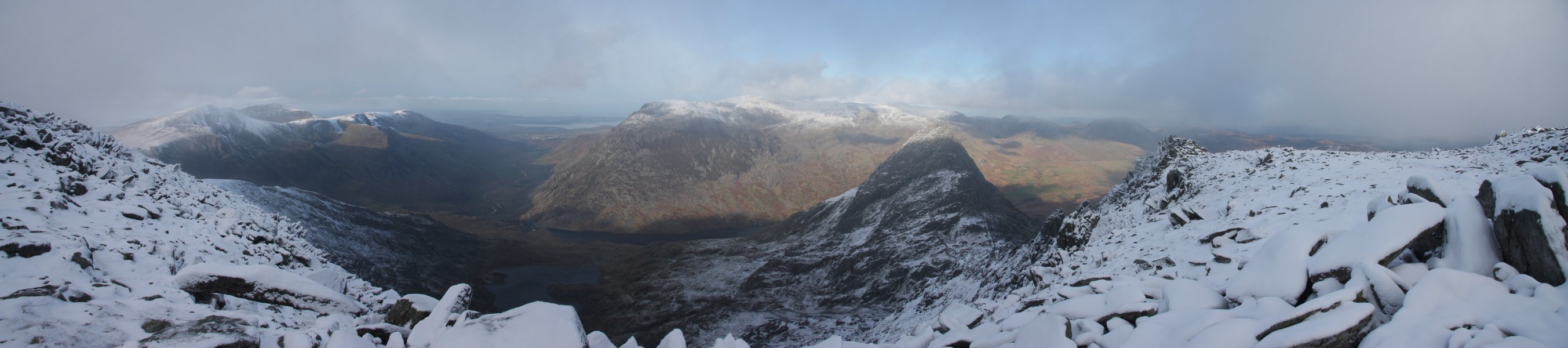 Clearing cloud over Cwm Bochlwyd. Y Garn, Elidir Fawr (924 metres), Foel-goch, Mynydd Pervedd, Carnedd y Filiast, Pen yr Ole Wen, Carnedd Dafydd, Carnedd Llewelyn, Tryfan, Pen yr Helgi Ddu and Pen Llithrig y Wrach.
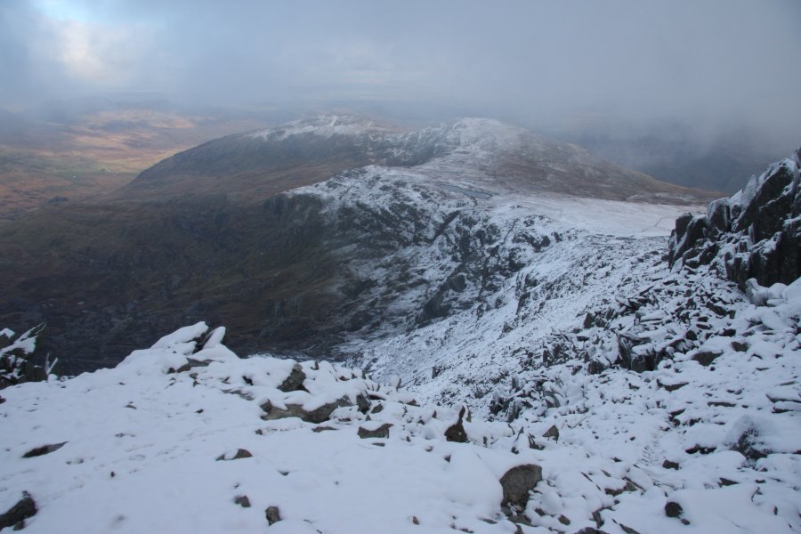 Y Foel Goch (805 metres) and Gallt yr Ogof.
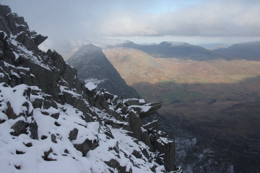 The way down gets quite steep here, but does not need any climbing equipment.
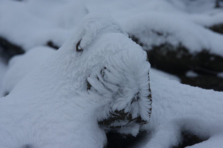 A dog's face in the ice. I think it's an Airedale.
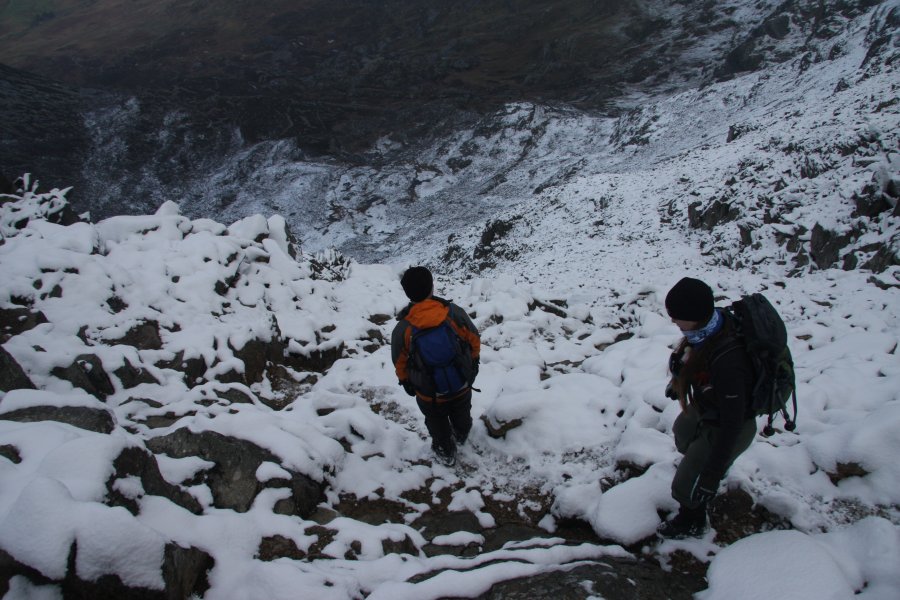 Steeply down into Cwm Tryfan.
 Too steep for comfort.
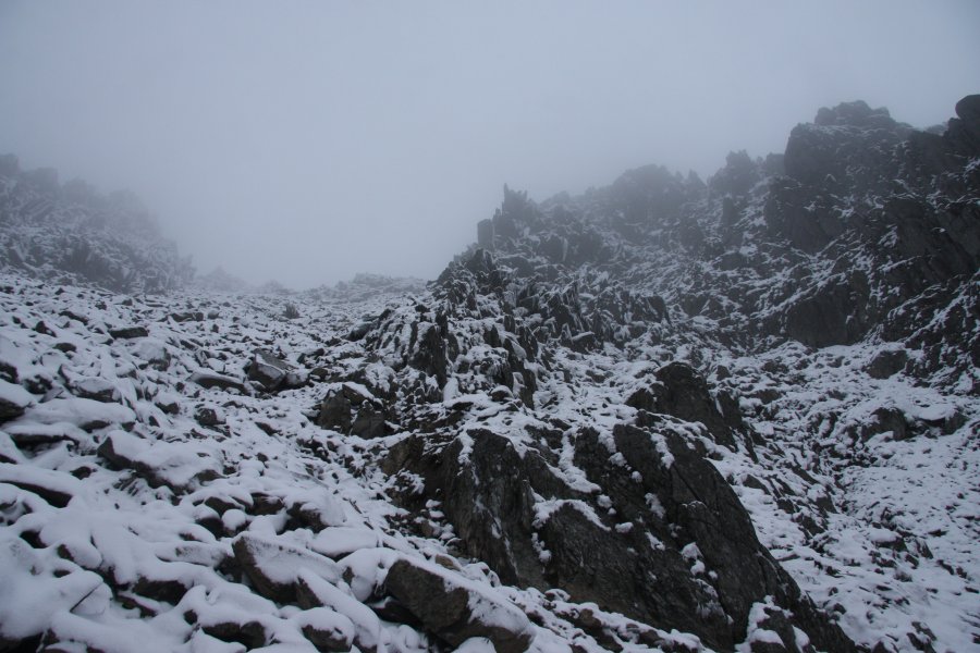 Looking up the couloir that we were descending.
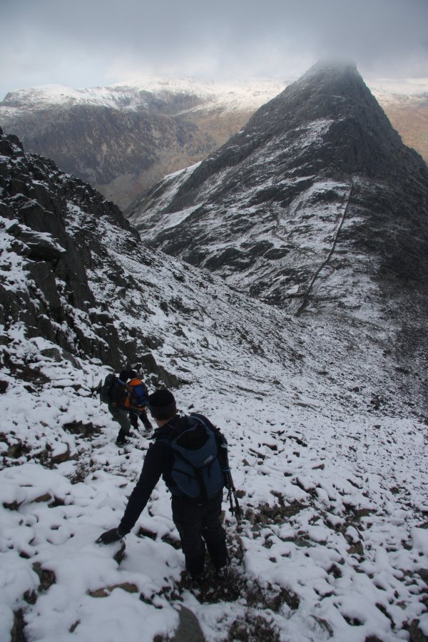 Approaching Bwlch Tryfan.
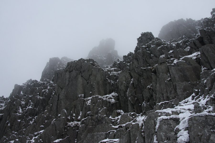 Spikes on Glyder Fawr.
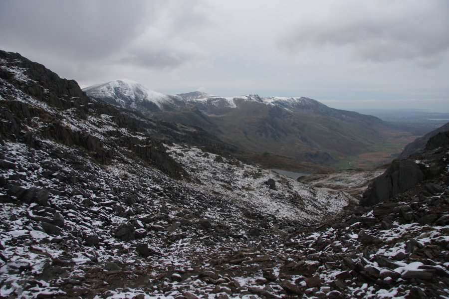 From Bwlch Tryfan, the route heads down into Cwm Bochlwyd. Even here, it's still a very long way down.
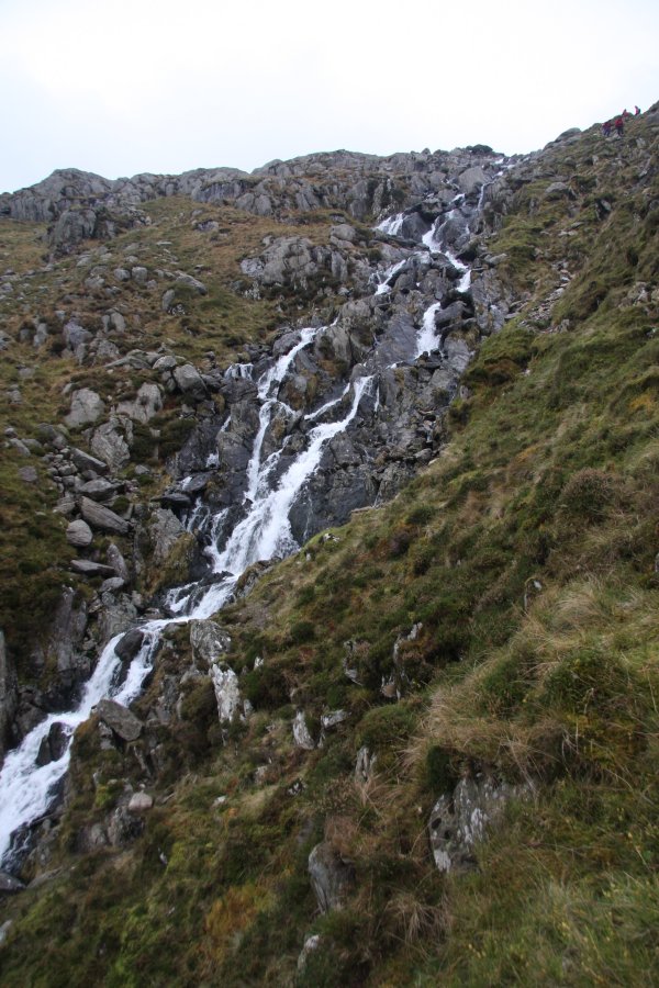 White water on Nant Bochlwyd. By now, we were running out of daylight, and needing to get to the next walk, so we said our goodbyes, and parted company on the mountainside.
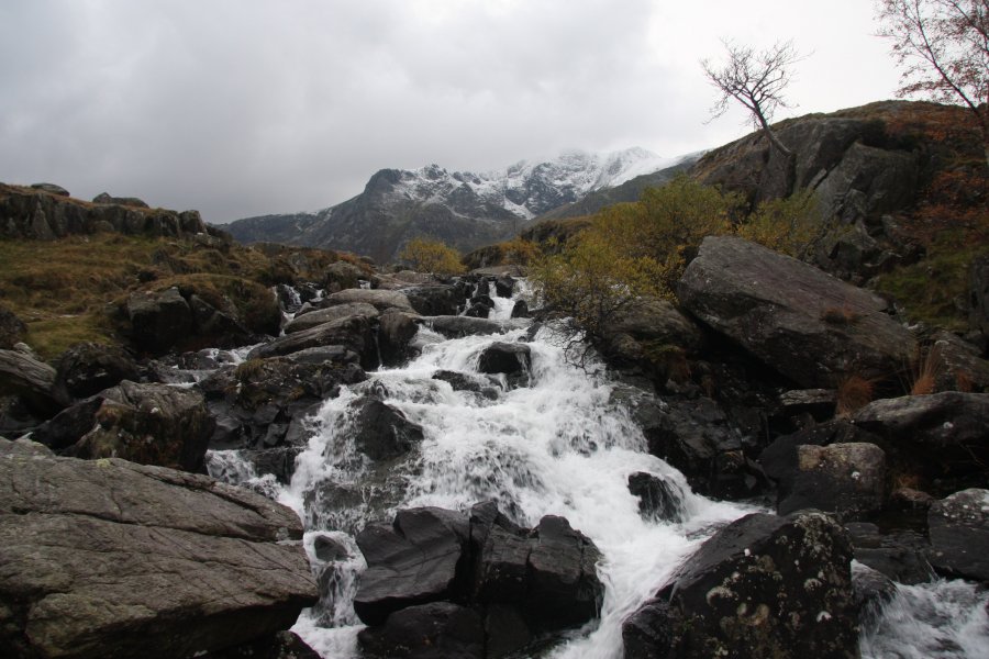 Running past Afon Idwal, near the end of the walk.
 The waterfall lies in the forest, Coed Cleiriach, on the left of this picture. By the time we got here, the light was already failing fast, and the camera's focal range suffers badly as a result (plus I think there was some mist in the lens). It was absolutely black in the forests, and by the time we reached the waterfall, there was only just enough light for us to see a shadow of it with our own eyes.
 The 5 metre Llyn yr Oror. With the camera balanced on a shaking fallen log, and our head-torches inadvertently throwing too much light into parts of the picture, this result had to be constructed from a 3 second shot (top) and 6 second shot (bottom). Amazingly, it just looks like a cloudy day. I could, of course, have tweaked the brightness and colours excessively to make it look better, but this is intended to be an honest representation of what has been termed "the gloomiest waterfall in Wales".
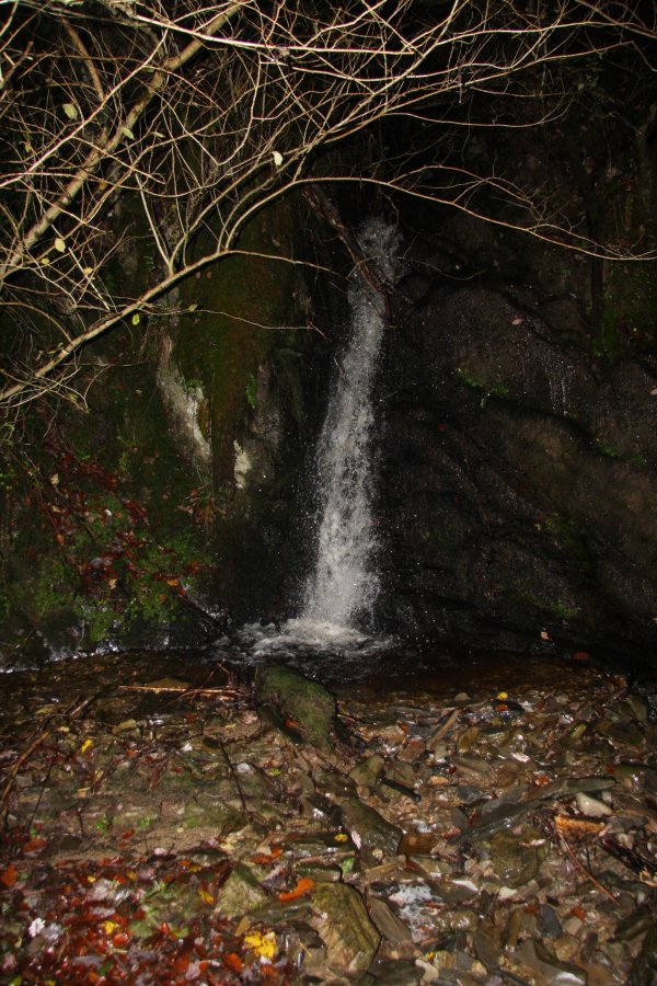 A small inlet stream has its own waterfall. Unfortunately, this also makes it very difficult to reach the main fall. A mossy scramble just beside the inlet is required to get down to it.
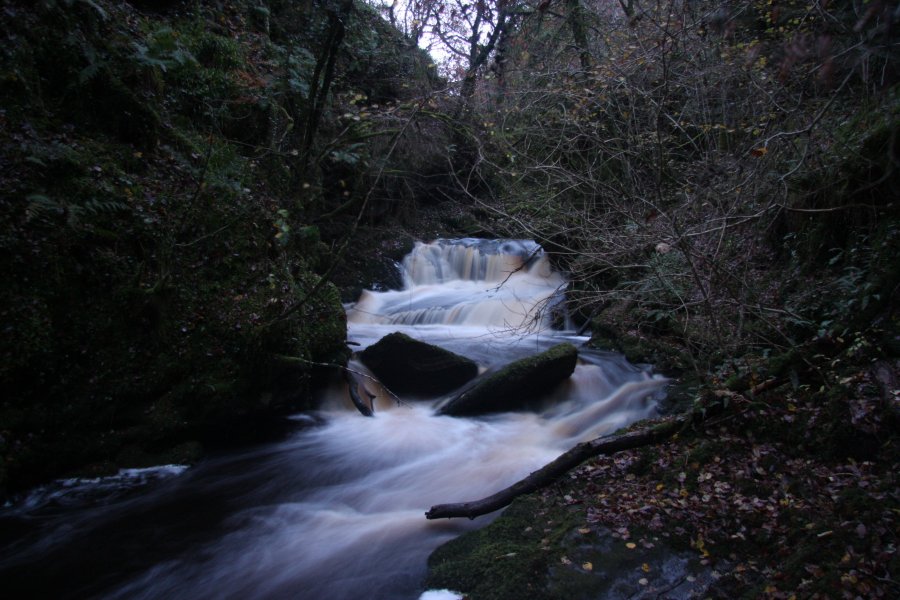 Just downstream in the Afon Aled is a small but powerful cascade. It is worth noting that the pictures here were taken when the reservoir was not overflowing. If it had been overflowing, it would almost certainly be too dangerous to be here.
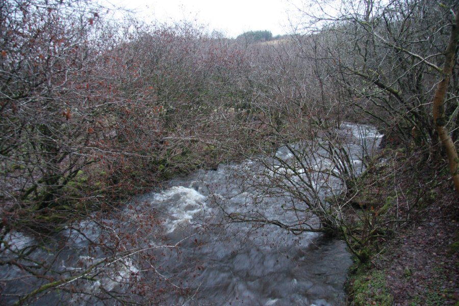 The river seen from Pont Cwm Pwll-y-Rhyd. With part of the river flowing into the Little Neath River Cave some way upstream, the remainder usually sinks at the corner seen in this picture, where a small passage can be followed into Bridge Cave.
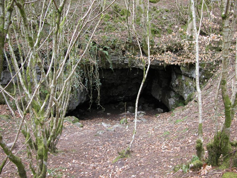 Just downstream from the bridge is the large entrance of Bridge Cave, which takes the river into Little Neath River Cave.
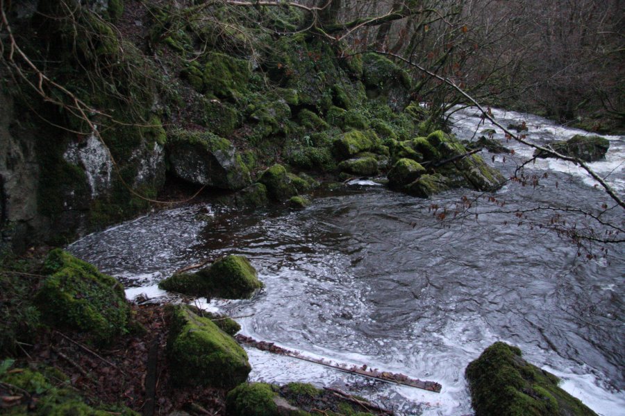 In high water, the river sinks into a swallow hole in the river bank a little way downstream, and makes its way into Bridge Cave. Any water that makes it past this point would normally sink into the river bed. In these flood conditions, however, the swallow hole cannot cope, and ponds up to 2 metres deep, with the river continuing past it.
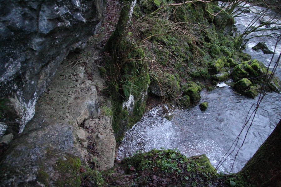 With the deep pool blocking the path, the way downstream is to very carefully traverse along an exposed, muddy ledge a few metres up in the cliff. Only experienced visitors should attempt this route.
 Finally free, the Nedd Fechan charges onwards into a little gorge, but that ominous fog at its end gives away what lies ahead.
 The path leads up over the gorge, from where there is a superb view of the river thundering down into Cwm Pwll-y-Rhyd (originally this was just called Pwll-y-Rhyd, but cavers have applied the name of the valley to the cave). The river never makes it past this point, where it is swallowed by the Cwm Pwll-y-Rhyd, White Lady and Town Drain caves, and onwards into the Little Neath River Cave.
 This is how the 4 metre waterfall normally looks, and looked on my visit in 2008.
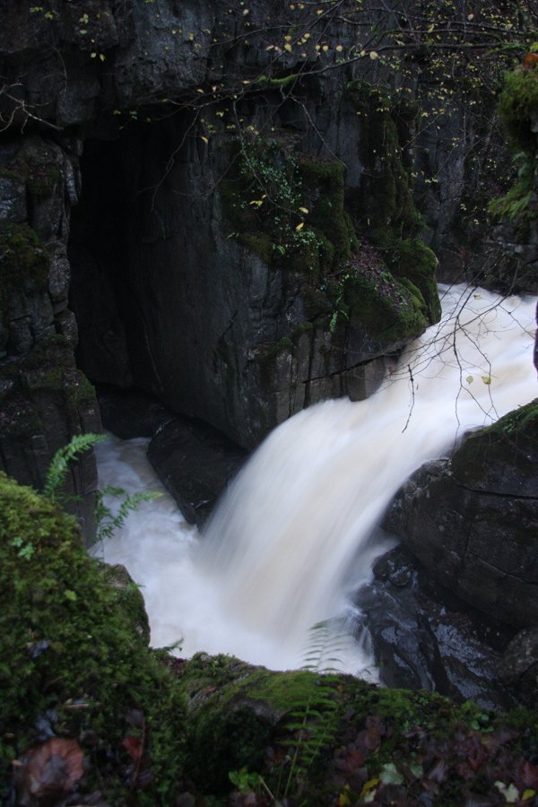 In these flood conditions, it's hardly recognisable as the same place. The plunge pool is 2 metres deeper than normal, and a natural rock bridge causes some of the water to be ejected part way down the waterfall.
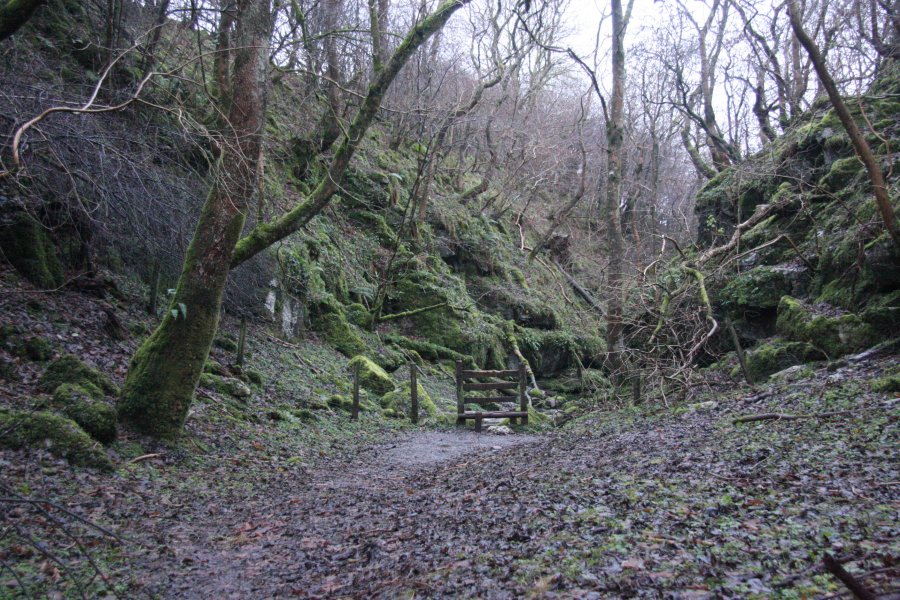 The dry valley that continues is the original Cwm Pwll-y-Rhyd.
 Alcoves hide additional entrances to the cave system.