Including Sychryd Cascades, Pwll y Berw, Sychryd Waterfall, Pwll y Crochan, Pwll-Du and Pwll Milast-fach.
From Cardiff, take the A470 to the end of Merthyr Tydfil. From Merthyr Tydfil, take the A465 to the left towards Hirwaun, follow it over the hill, and down to the next roundabout. Take the second turnoff, remaining on the A465, to the next roundabout. Take the second turnoff onto the A465 dual carriageway. For Pwll-Du and Pwll Milast-fach, park at the third lay-by (directly opposite the path to Pwll y Crochan). SN 9260 0697. For the lower and middle gorge sections, take the first exit off the road after about 4.5 miles. Turn right at the traffic lights (the start of Glyn-neath). Take the first proper left, and follow it until the road forks just before a slope up. Take the right fork, and follow it until the road swings over a narrow bridge to the parking area at the base of the Dinas Rock. SN 9109 0793.
For Pwll y Crochan, turn around in Glyn-neath, and return along the A465 dual carriageway towards Hirwaun. Just after the road finishes climbing up the hill from the Neath Valley, park in a new lay-by just beyond a grassed-over lay-by (directly opposite the path to Pwll Milast-fach). SN 9284 0690.
The gorge is split into three sections. Only the lower and middle sections have proper paths and by far the most dramatic scenery, while the upper section is severely lacking in access routes. This guide concentrates on the lower and middle sections.
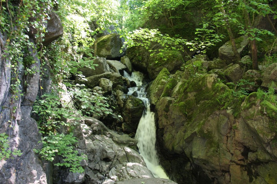
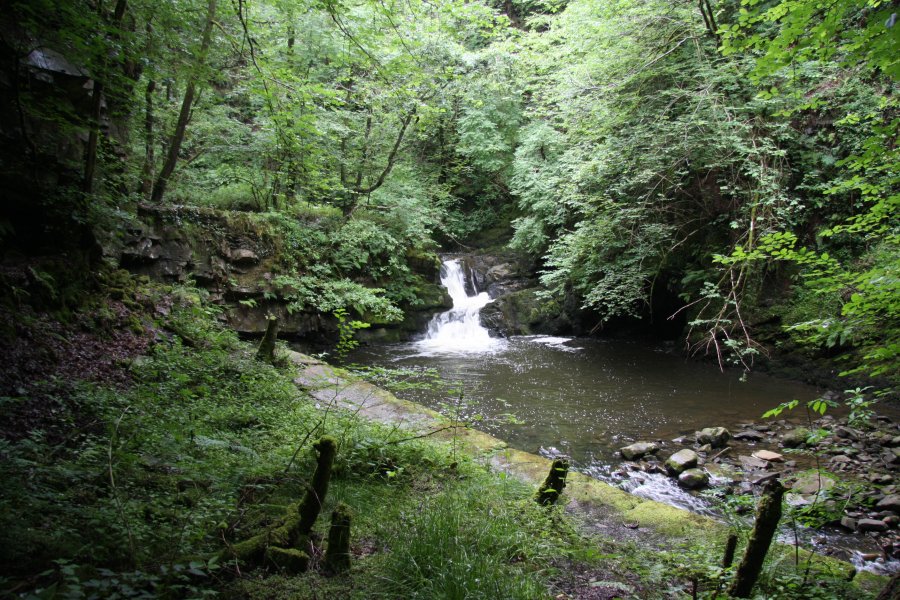
The lower section has a very easy (all-ability) access trail, starting on the right side of the parking area, heading into the Sychryd Gorge. (There is also another path to its right, leading to changing facilities.) Follow the trail to the Sychryd Cascades. Just before them, a narrow path heads down to the lowest cascade, which spans the river. (Experienced cavers or gorge walkers may consider - at their own risk - scrambling up the left side of the cascades to reach the upper path, which may be used as a shortcut to the next waterfalls. The path is deteriorating though, and has collapsed into the river in places. An alternative shortcut is to ford the river, and invent a path from the far bank upstream around the large rock outcrop, taking care to avoid the crags at the other end. Neither of these options are considered part of this route guide, and are not graded. The safest route is to return to the parking area.)
The middle section of the gorge is accessed from a path starting on the left side of the parking area. It climbs steeply up the left side of the Dinas Rock, before levelling out at the top. Follow the path along the rock, to a point where the Sychryd gorge is just about to swing away to the right, where the path splits. Ahead-left, the path continues to the Four Waterfalls trail, while the way on is to the right. The path soon splits again, where to the right drops down into the Sychryd Gorge.
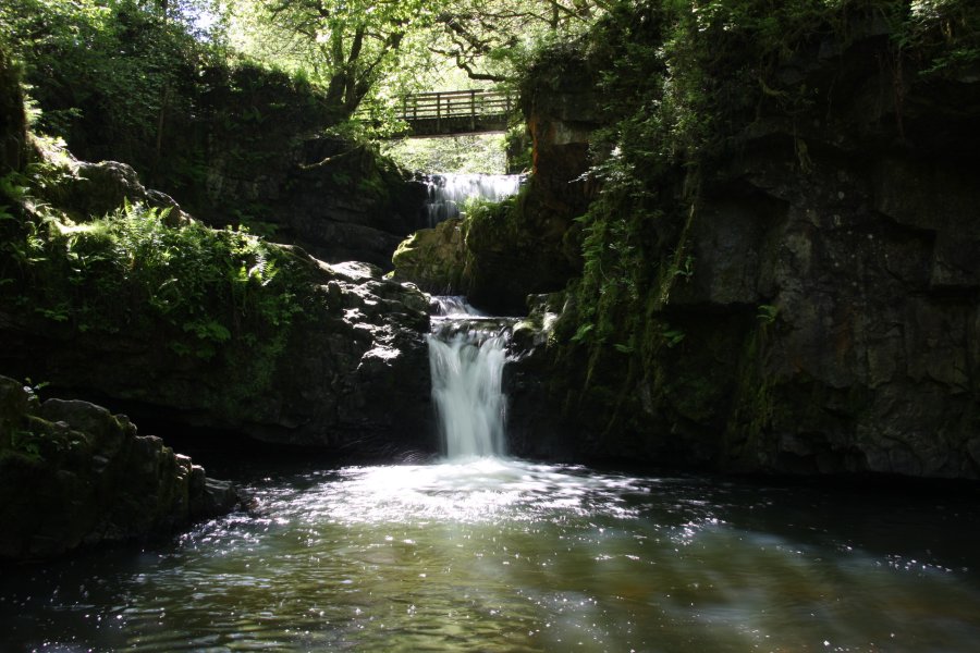
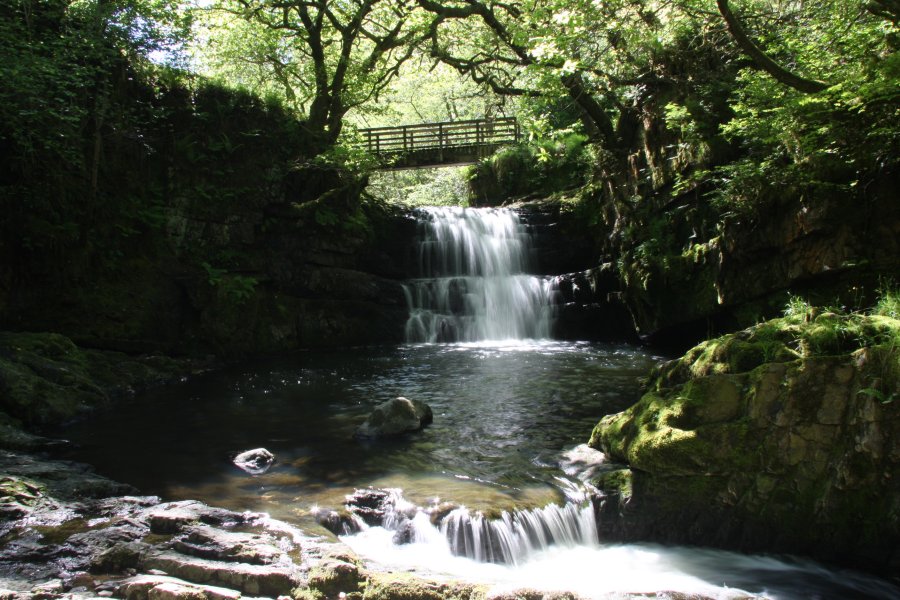
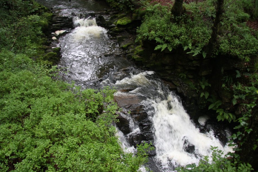
Follow the path down some steps to arrive in an impressive amphitheatre of crags, with the Dinas Quartzite Mines on the left, the closed old path to the right, waterfalls in the river below, and a footbridge crossing over to an old tunnel on the far bank. (Some walkers invent a path through the forest to the right of the tunnel, over the rock outcrop to the Sychryd Cascades.) Directly under the footbridge is the Sychryd Waterfall, and immediately below that is the smaller waterfall landing in Pwll y Berw. There are small scrambling paths down to each of these for daring photographers.
Remaining on the left bank of the river, a path continues upstream, and it used to lead towards an upper waterfall, but this path has now decayed to the point that it cannot be followed far. Following the path soon reaches a small abandoned building, and shortly afterwards, the path disappears into the undergrowth. From this point, experienced visitors can choose to continue through brambles to a small stream valley on the left. From here, there is a choice of either ascending the left bank through the forest then staying at the top edge of the main river valley, or continuing on the left bank of the main river. Either way, there is no useful path, and the waterfall is difficult to reach. If staying at river level, the river will need to be crossed a couple of times to reach the final, unnamed waterfall, and suitable water levels and footwear will be required. If staying at the top of the valley, a careful descent will need to be made at the right point to reach the waterfall, with great care to avoid the cliff shortly before it. (A path exists 500 metres further from the river through the forest, and it continues beyond this, passing through fields to arrive at the Rhigos industrial estate, but it does not provide any useful way to access the upper part of the gorge.)
If you feel the need to visit the rather poor Pwll y Crochan, start from the lay-by. Head back along the side of the road (against the flow of traffic) for about 400 metres, past the far end of the older, grassed-over lay-by. 100 metres beyond the start of the old lay-by, a while after the crash barrier has restarted, a stepped path can be seen behind the crash barrier. This leads down two sets of steps to the head of the waterfall, just as the river emerges from its tunnel under the road.
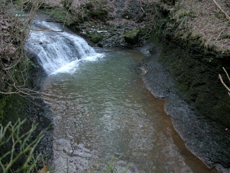
Likewise, Pwll-Du can be accessed from its lay-by on the other side of the road from Pwll y Crochan (although you can in theory cross the road, it is much safer to drive to it). At the start of the lay-by, tucked behind the crash barrier, is a stepped path leading directly to the Pwll-Du waterfall. The Pwll Milast-fach waterfalls are much harder to reach, and should only be visited by walkers who are experienced in exploring gorges without paths. At the start of the lay-by, head up onto the grassy area before the lay-by. Cross it diagonally, away from the road. Carefully locate somewhere safe enough to descend through the forest (watch out for the crags at the Pwll-Du end), such as the point where a fence descends into the valley, and slowly drop down the steep banks to the junction of the streams. There are small waterfalls located just upstream on each branch, and the newly formed Sychryd. None are really worth the effort.
| Waterfall | Grid reference | GPS coordinates | Image |
|---|---|---|---|
| Sychryd Cascades/Sgydau Sychryd | SN 91465 08000 | 51.760133°N, 3.573988°W | |
| Pwll y Berw | SN 91639 08009 | 51.760247°N, 3.571471°W | |
| Sychryd Waterfall | SN 91652 07979 | 51.759980°N, 3.571273°W | |
| Pwll y Crochan | SN 92549 07126 | 51.752487°N, 3.558018°W | |
| Pwll-Du | SN 92607 06877 | 51.750260°N, 3.557101°W | |
| Pwll Milast-fach | SN 92672 06842 | 51.749958°N, 3.556149°W | |
Whilst every care has been taken in the compilation of this description, neither the author nor his fellow walkers can accept responsibility for loss or injury arising from any errors, omissions or inaccuracies in this description. This description is intended as a guide only, and you should select a route to suit your own abilities, at your own discretion. Ability requirements are a guide only. Route maps are approximated. You follow this description at your own risk.